Liiva geodata
Liiva (Saare) is a seat of a second-order administrative division; located in Estonia in Europe/Tallinn (GMT+3) time zone. In our database, there are 184 cities with bigger population. Compared to other cities in Estonia, 61.1% of cities are located further ↑North; 94.7% of cities are located further →East and 82.6% of cities have higher elevation than Liiva. Note1


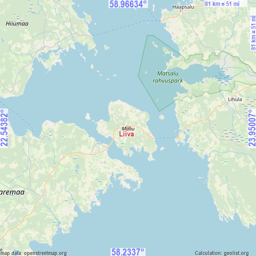
Liiva GPS coordinates[2]
58° 36' 6.984" North, 23° 14' 48.984" East
| Map corner | latitude | longitude |
|---|---|---|
| Upper-left | 58.96634°, | 22.54382° |
| Center: | 58.60194°, | 23.24694° |
| Lower-right: | 58.2337°, | 23.95007° |
| Map W x H: | 81.5×81.5 km | = 50.6×50.6mi |
| max Lat: | 59.57639° ⇑61.1% North |
| Liiva: | 58.60194° |
| min Lat: | ⇓38.9% South 57.72778° |
| min Long | Liiva | max Long |
| 22.24646° | 23.24694° | 28.19028° |
| W 5.3%⇐ | ⇒94.7% E |
Elevation
Elevation of Liiva is 21 m = 69 ft, and this is 32.2 m = 106 ft below average elevation for this country.
| Max E: |
141 m = 463 ft | 82.6% |
| Avg. | 53.2 m = 175 ft | |
| Liiva | 21 m = 69 ft | |
Min E: |
6 m = 20 ft | 17.4% |
See also: Estonia elevation on elevation.city.
Geographical zone
Liiva is located in North temperate zone (between Tropic of Cancer and the Arctic Circle). Distance of this North polar circle is 885.2 km =550 mi to North.| Distance of | km | miles | from Liiva |
|---|---|---|---|
| North Pole | 3491.1 | 2169.3 | to North |
| Arctic Circle | 885.2 | 550 | to North |
| Tropic Cancer | 3910 | 2429.6 | to South |
| Equator | 6515.9 | 4048.8 | to South |


Nearby cities:
15 places around Liiva: (largest is in red/bold)
• Aste
54.1 km =33.6 mi,  237°
237°
• Haapsalu
41.6 km =25.8 mi,  24°
24°
• Hullo
43.2 km =26.8 mi,  359°
359°
• Kuressaare
58.5 km =36.4 mi,  227°
227°
• Käina
37 km =23 mi,  312°
312°
• Kärdla
52.5 km =32.6 mi,  326°
326°
• Lihula
35.7 km =22.2 mi,  75°
75°
• Orissaare
10.6 km =6.6 mi, 243°
• Palivere
55.7 km =34.6 mi,  42°
42°
• Risti
34.6 km =21.5 mi,  97°
97°
• Taebla
48.8 km =30.3 mi, 36°
• Tõstamaa
53 km =32.9 mi,  124°
124°
• Uuemõisa
42.4 km =26.3 mi,  27°
27°
• Valjala
33.8 km =21 mi, 229°
• Virtsu
16.4 km =10.2 mi, 102°
Sources, notices
• [Note1] Compared only with cities in Estonia existing in our database
• [Src1] Map data: © OpenStreetMap contributors (CC-BY-SA)
• [Src2] Other city data from geonames.org with taken over terms of usage.
• [Src3] Geographical zone / Annual Mean Temperature by Robert A. Rohde @ Wikipedia
