Käina geodata
Käina (Hiiumaa) is a populated place; located in Estonia in Europe/Tallinn (GMT+3) time zone. With population of 854 people, there are 105 cities with bigger population in this country. Compared to other cities in Estonia, 51.1% of cities are located further ↑North; 96.8% of cities are located further →East and 93.2% of cities have higher elevation than Käina. Note1


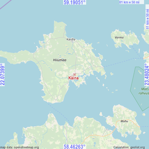
Käina GPS coordinates[2]
58° 49' 42.528" North, 22° 46' 37.596" East
| Map corner | latitude | longitude |
|---|---|---|
| Upper-left | 59.19051°, | 22.07399° |
| Center: | 58.82848°, | 22.77711° |
| Lower-right: | 58.46263°, | 23.48024° |
| Map W x H: | 80.9×80.9 km | = 50.3×50.3mi |
| max Lat: | 59.57639° ⇑51.1% North |
| Käina: | 58.82848° |
| min Lat: | ⇓48.9% South 57.72778° |
| min Long | Käina | max Long |
| 22.24646° | 22.77711° | 28.19028° |
| W 3.2%⇐ | ⇒96.8% E |
Elevation
Elevation of Käina is 10 m = 33 ft, and this is 43.2 m = 142 ft below average elevation for this country.
| Max E: |
141 m = 463 ft | 93.2% |
| Avg. | 53.2 m = 175 ft | |
| Käina | 10 m = 33 ft | |
Min E: |
6 m = 20 ft | 6.8% |
See also: Estonia elevation on elevation.city.
Geographical zone
Käina is located in North temperate zone (between Tropic of Cancer and the Arctic Circle). Distance of this North polar circle is 860.1 km =534.4 mi to North.| Distance of | km | miles | from Käina |
|---|---|---|---|
| North Pole | 3465.9 | 2153.6 | to North |
| Arctic Circle | 860.1 | 534.4 | to North |
| Tropic Cancer | 3935.2 | 2445.2 | to South |
| Equator | 6541.1 | 4064.4 | to South |


Nearby cities:
15 places around Käina: (largest is in red/bold)
• Aste
57 km =35.4 mi,  198°
198°
• Haapsalu
45.7 km =28.4 mi,  73°
73°
• Hullo
32.3 km =20.1 mi,  56°
56°
• Kuressaare
66.5 km =41.3 mi,  193°
193°
• Kärdla
18.9 km =11.7 mi,  355°
355°
• Kärla
62.4 km =38.8 mi,  208°
208°
• Lihula
63.7 km =39.6 mi,  104°
104°
• Liiva
37 km =23 mi,  132°
132°
• Orissaare
34.8 km =21.6 mi,  149°
149°
• Palivere
66.6 km =41.4 mi,  76°
76°
• Risti
68.2 km =42.4 mi,  115°
115°
• Taebla
57.7 km =35.9 mi, 76°
• Uuemõisa
48.3 km =30 mi, 75°
• Valjala
47 km =29.2 mi,  178°
178°
• Virtsu
51.8 km =32.2 mi, 123°
Sources, notices
• [Note1] Compared only with cities in Estonia existing in our database
• [Src1] Map data: © OpenStreetMap contributors (CC-BY-SA)
• [Src2] Other city data from geonames.org with taken over terms of usage.
• [Src3] Geographical zone / Annual Mean Temperature by Robert A. Rohde @ Wikipedia
