Kärla geodata
Kärla (Saare) is a populated place; located in Estonia in Europe/Tallinn (GMT+3) time zone. With population of 988 people, there are 93 cities with bigger population in this country. Compared to other cities in Estonia, 76.3% of cities are located further ↑North; 99.5% of cities are located further →East and 82.6% of cities have higher elevation than Kärla. Note1


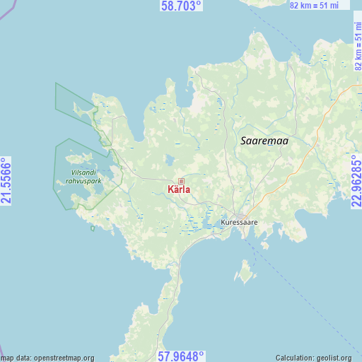
Kärla GPS coordinates[2]
58° 20' 8.988" North, 22° 15' 34.992" East
| Map corner | latitude | longitude |
|---|---|---|
| Upper-left | 58.703°, | 21.5566° |
| Center: | 58.33583°, | 22.25972° |
| Lower-right: | 57.9648°, | 22.96285° |
| Map W x H: | 82.1×82.1 km | = 51×51mi |
| max Lat: | 59.57639° ⇑76.3% North |
| Kärla: | 58.33583° |
| min Lat: | ⇓23.7% South 57.72778° |
| min Long | Kärla | max Long |
| 22.24646° | 22.25972° | 28.19028° |
| W 0.5%⇐ | ⇒99.5% E |
Elevation
Elevation of Kärla is 21 m = 69 ft, and this is 32.2 m = 106 ft below average elevation for this country.
| Max E: |
141 m = 463 ft | 82.6% |
| Avg. | 53.2 m = 175 ft | |
| Kärla | 21 m = 69 ft | |
Min E: |
6 m = 20 ft | 17.4% |
See also: Estonia elevation on elevation.city.
Geographical zone
Kärla is located in North temperate zone (between Tropic of Cancer and the Arctic Circle). Distance of this North polar circle is 914.8 km =568.4 mi to North.| Distance of | km | miles | from Kärla |
|---|---|---|---|
| North Pole | 3520.7 | 2187.7 | to North |
| Arctic Circle | 914.8 | 568.4 | to North |
| Tropic Cancer | 3880.4 | 2411.2 | to South |
| Equator | 6486.3 | 4030.4 | to South |


Nearby cities:
15 places around Kärla: (largest is in red/bold)
• Aste
11.7 km =7.3 mi,  85°
85°
• Haapsalu
100.3 km =62.3 mi,  47°
47°
• Hullo
92.4 km =57.4 mi,  38°
38°
• Kuressaare
17.3 km =10.7 mi,  124°
124°
• Käina
62.4 km =38.8 mi,  28°
28°
• Kärdla
78.9 km =49 mi,  21°
21°
• Lihula
99.8 km =62 mi,  67°
67°
• Liiva
64.6 km =40.1 mi,  62°
62°
• Orissaare
53.9 km =33.5 mi, 62°
• Risti
95.2 km =59.2 mi, 74°
• Ruhnu
83.2 km =51.7 mi,  135°
135°
• Salme
19.4 km =12.1 mi,  179°
179°
• Tehumardi
17.3 km =10.7 mi, 182°
• Valjala
32.5 km =20.2 mi,  76°
76°
• Virtsu
78 km =48.5 mi, 70°
Sources, notices
• [Note1] Compared only with cities in Estonia existing in our database
• [Src1] Map data: © OpenStreetMap contributors (CC-BY-SA)
• [Src2] Other city data from geonames.org with taken over terms of usage.
• [Src3] Geographical zone / Annual Mean Temperature by Robert A. Rohde @ Wikipedia
