Al Maḩallah al Kubrá geodata
Al Maḩallah al Kubrá (Gharbia) is a populated place; located in Egypt in Africa/Cairo (GMT+2) time zone. With population of 431,052 people, there are 5 cities with bigger population in this country. Compared to other cities in Egypt, 77.5% of cities are located further ↓South; 60.1% of cities are located further →East and 50.7% of cities have higher elevation than Al Maḩallah al Kubrá. Note1


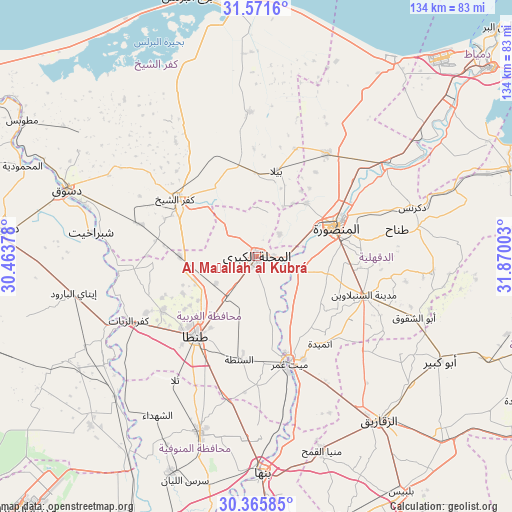
Al Maḩallah al Kubrá GPS coordinates[2]
30° 58' 14.268" North, 31° 10' 0.84" East
| Map corner | latitude | longitude |
|---|---|---|
| Upper-left | 31.5716°, | 30.46378° |
| Center: | 30.97063°, | 31.1669° |
| Lower-right: | 30.36585°, | 31.87003° |
| Map W x H: | 134.1×134.1 km | = 83.3×83.3mi |
| max Lat: | 31.5084° ⇑22.5% North |
| Al Maḩallah al Kubrá: | 30.97063° |
| min Lat: | ⇓77.5% South 22.3457° |
| min Long | Al Maḩallah a | max Long |
| 25.51965° | 31.1669° | 34.89572° |
| W 39.9%⇐ | ⇒60.1% E |
Elevation
Elevation of Al Maḩallah al Kubrá is 17 m = 56 ft, and this is 26.5 m = 87 ft below average elevation for this country.
| Max E: |
1565 m = 5135 ft | 50.7% |
| Avg. | 43.5 m = 143 ft | |
| Al Maḩallah al Kubrá | 17 m = 56 ft | |
Min E: |
-15 m = -49 ft | 49.3% |
See also: Al Maḩallah al Kubrá elevation on elevation.city.
Geographical zone
Al Maḩallah al Kubrá is located in North temperate zone (between Tropic of Cancer and the Arctic Circle). Distance of this Northern Tropic circle is 837.7 km =520.5 mi to South.| Distance of | km | miles | from Al Maḩallah al Kubrá |
|---|---|---|---|
| North Pole | 6563.5 | 4078.4 | to North |
| Arctic Circle | 3957.6 | 2459.1 | to North |
| Tropic Cancer | 837.7 | 520.5 | to South |
| Equator | 3443.6 | 2139.8 | to South |


Nearby cities:
15 places around Al Maḩallah al Kubrá: (largest is in red/bold)
• Ajā
12.2 km =7.6 mi,  105°
105°
• Al Manşūrah
21.6 km =13.4 mi,  70°
70°
• Al Ḩāmūl
37.9 km =23.5 mi,  357°
357°
• Basyūn
33.9 km =21.1 mi,  264°
264°
• Bilqās
32.7 km =20.3 mi,  33°
33°
• Diyarb Najm
35.5 km =22.1 mi,  132°
132°
• Kafr ash Shaykh
26.7 km =16.6 mi,  305°
305°
• Kafr az Zayyāt
37 km =23 mi,  244°
244°
• Quţūr
20.1 km =12.5 mi,  270°
270°
• Samannūd
7.1 km =4.4 mi,  98°
98°
• Shirbīn
42.3 km =26.3 mi,  53°
53°
• Talā
38.7 km =24 mi,  213°
213°
• Tanda
25.7 km =16 mi,  217°
217°
• Zefta
29.5 km =18.3 mi,  165°
165°
• Ţalkhā
22.1 km =13.7 mi, 65°
Sources, notices
• [Note1] Compared only with cities in Egypt existing in our database
• [Src1] Map data: © OpenStreetMap contributors (CC-BY-SA)
• [Src2] Other city data from geonames.org with taken over terms of usage.
• [Src3] Geographical zone / Annual Mean Temperature by Robert A. Rohde @ Wikipedia
