Mallawī geodata
Mallawī (Minya) is a populated place; located in Egypt in Africa/Cairo (GMT+2) time zone. With population of 142,504 people, there are 27 cities with bigger population in this country. Compared to other cities in Egypt, 75.4% of cities are located further ↑North; 77.5% of cities are located further →East and 76.1% of cities have lower elevation than Mallawī. Note1


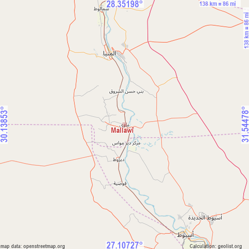
Mallawī GPS coordinates[2]
27° 43' 53.04" North, 30° 50' 29.94" East
| Map corner | latitude | longitude |
|---|---|---|
| Upper-left | 28.35198°, | 30.13853° |
| Center: | 27.7314°, | 30.84165° |
| Lower-right: | 27.10727°, | 31.54478° |
| Map W x H: | 138.4×138.4 km | = 86×86mi |
| max Lat: | 31.5084° ⇑75.4% North |
| Mallawī: | 27.7314° |
| min Lat: | ⇓24.6% South 22.3457° |
| min Long | Mallawī | max Long |
| 25.51965° | 30.84165° | 34.89572° |
| W 22.5%⇐ | ⇒77.5% E |
Elevation
Elevation of Mallawī is 52 m = 171 ft, and this is 8.5 m = 28 ft above average elevation for this country.
| Max E: |
1565 m = 5135 ft | 23.9% |
| Mallawī | 52 m 171 ft | |
| Avg. | 43.5 m = 143 ft | |
Min E: |
-15 m = -49 ft | 76.1% |
See also: Mallawī elevation on elevation.city.
Geographical zone
Mallawī is located in North temperate zone (between Tropic of Cancer and the Arctic Circle). Distance of this Northern Tropic circle is 477.5 km =296.7 mi to South.| Distance of | km | miles | from Mallawī |
|---|---|---|---|
| North Pole | 6923.6 | 4302.1 | to North |
| Arctic Circle | 4317.7 | 2682.9 | to North |
| Tropic Cancer | 477.5 | 296.7 | to South |
| Equator | 3083.4 | 1915.9 | to South |


Nearby cities:
15 places around Mallawī: (largest is in red/bold)
• Abnūb
59.7 km =37.1 mi,  149°
149°
• Abū Qurqāş
22.2 km =13.8 mi,  359°
359°
• Abū Tīj
89.8 km =55.8 mi, 148°
• Al Badārī
99.8 km =62 mi, 145°
• Al Fashn
121.7 km =75.6 mi,  2°
2°
• Al Minyā
43 km =26.7 mi,  347°
347°
• Al Qūşīyah
32.5 km =20.2 mi,  184°
184°
• Asyūţ
69.9 km =43.4 mi, 151°
• Banī Mazār
86 km =53.4 mi, 357°
• Dayr Mawās
10 km =6.2 mi, 177°
• Dayrūţ
19.8 km =12.3 mi,  189°
189°
• Manfalūţ
48.5 km =30.1 mi,  164°
164°
• Maţāy
76.7 km =47.7 mi, 355°
• Samālūţ
65.9 km =40.9 mi, 348°
• Ţahţā
125.3 km =77.9 mi, 148°
Sources, notices
• [Note1] Compared only with cities in Egypt existing in our database
• [Src1] Map data: © OpenStreetMap contributors (CC-BY-SA)
• [Src2] Other city data from geonames.org with taken over terms of usage.
• [Src3] Geographical zone / Annual Mean Temperature by Robert A. Rohde @ Wikipedia
