Dayrūţ geodata
Dayrūţ (Asyut) is a populated place; located in Egypt in Africa/Cairo (GMT+2) time zone. With population of 67,788 people, there are 56 cities with bigger population in this country. Compared to other cities in Egypt, 76.8% of cities are located further ↑North; 81.2% of cities are located further →East and 76.1% of cities have lower elevation than Dayrūţ. Note1


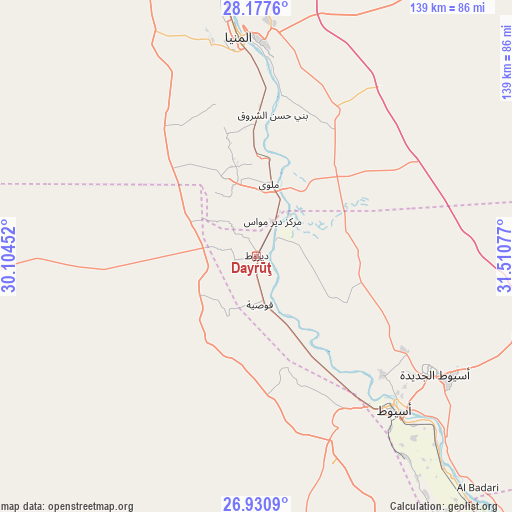
Dayrūţ GPS coordinates[2]
27° 33' 21.672" North, 30° 48' 27.504" East
| Map corner | latitude | longitude |
|---|---|---|
| Upper-left | 28.1776°, | 30.10452° |
| Center: | 27.55602°, | 30.80764° |
| Lower-right: | 26.9309°, | 31.51077° |
| Map W x H: | 138.6×138.6 km | = 86.1×86.1mi |
| max Lat: | 31.5084° ⇑76.8% North |
| Dayrūţ: | 27.55602° |
| min Lat: | ⇓23.2% South 22.3457° |
| min Long | Dayrūţ | max Long |
| 25.51965° | 30.80764° | 34.89572° |
| W 18.8%⇐ | ⇒81.2% E |
Elevation
Elevation of Dayrūţ is 52 m = 171 ft, and this is 8.5 m = 28 ft above average elevation for this country.
| Max E: |
1565 m = 5135 ft | 23.9% |
| Dayrūţ | 52 m 171 ft | |
| Avg. | 43.5 m = 143 ft | |
Min E: |
-15 m = -49 ft | 76.1% |
See also: Dayrūţ elevation on elevation.city.
Geographical zone
Dayrūţ is located in North temperate zone (between Tropic of Cancer and the Arctic Circle). Distance of this Northern Tropic circle is 458 km =284.6 mi to South.| Distance of | km | miles | from Dayrūţ |
|---|---|---|---|
| North Pole | 6943.1 | 4314.2 | to North |
| Arctic Circle | 4337.2 | 2695 | to North |
| Tropic Cancer | 458 | 284.6 | to South |
| Equator | 3063.9 | 1903.8 | to South |


Nearby cities:
15 places around Dayrūţ: (largest is in red/bold)
• Abnūb
46.5 km =28.9 mi,  133°
133°
• Abū Qurqāş
41.8 km =26 mi,  4°
4°
• Abū Tīj
76.1 km =47.3 mi,  138°
138°
• Al Badārī
86.8 km =53.9 mi, 136°
• Al Minyā
61.8 km =38.4 mi,  354°
354°
• Al Qūşīyah
12.9 km =8 mi,  175°
175°
• Asyūţ
55.8 km =34.7 mi, 138°
• Banī Mazār
105.4 km =65.5 mi,  359°
359°
• Dayr Mawās
10.3 km =6.4 mi,  21°
21°
• Juhaynah
119.6 km =74.3 mi,  145°
145°
• Mallawī
19.8 km =12.3 mi,  9°
9°
• Manfalūţ
31.7 km =19.7 mi, 149°
• Maţāy
96 km =59.7 mi, 358°
• Samālūţ
84.6 km =52.6 mi, 353°
• Ţahţā
111.2 km =69.1 mi, 141°
Sources, notices
• [Note1] Compared only with cities in Egypt existing in our database
• [Src1] Map data: © OpenStreetMap contributors (CC-BY-SA)
• [Src2] Other city data from geonames.org with taken over terms of usage.
• [Src3] Geographical zone / Annual Mean Temperature by Robert A. Rohde @ Wikipedia
