Dayr Mawās geodata
Dayr Mawās (Minya) is a populated place; located in Egypt in Africa/Cairo (GMT+2) time zone. With population of 40,609 people, there are 103 cities with bigger population in this country. Compared to other cities in Egypt, 76.1% of cities are located further ↑North; 76.1% of cities are located further →East and 74.6% of cities have lower elevation than Dayr Mawās. Note1


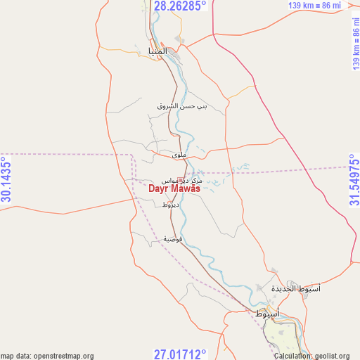
Dayr Mawās GPS coordinates[2]
27° 38' 30.336" North, 30° 50' 47.832" East
| Map corner | latitude | longitude |
|---|---|---|
| Upper-left | 28.26285°, | 30.1435° |
| Center: | 27.64176°, | 30.84662° |
| Lower-right: | 27.01712°, | 31.54975° |
| Map W x H: | 138.5×138.5 km | = 86.1×86.1mi |
| max Lat: | 31.5084° ⇑76.1% North |
| Dayr Mawās: | 27.64176° |
| min Lat: | ⇓23.9% South 22.3457° |
| min Long | Dayr Mawās | max Long |
| 25.51965° | 30.84662° | 34.89572° |
| W 23.9%⇐ | ⇒76.1% E |
Elevation
Elevation of Dayr Mawās is 48 m = 157 ft, and this is 4.5 m = 15 ft above average elevation for this country.
| Max E: |
1565 m = 5135 ft | 25.4% |
| Dayr Mawās | 48 m 157 ft | |
| Avg. | 43.5 m = 143 ft | |
Min E: |
-15 m = -49 ft | 74.6% |
See also: Dayr Mawās elevation on elevation.city.
Geographical zone
Dayr Mawās is located in North temperate zone (between Tropic of Cancer and the Arctic Circle). Distance of this Northern Tropic circle is 467.6 km =290.6 mi to South.| Distance of | km | miles | from Dayr Mawās |
|---|---|---|---|
| North Pole | 6933.6 | 4308.3 | to North |
| Arctic Circle | 4327.7 | 2689.1 | to North |
| Tropic Cancer | 467.6 | 290.6 | to South |
| Equator | 3073.5 | 1909.8 | to South |


Nearby cities:
15 places around Dayr Mawās: (largest is in red/bold)
• Abnūb
51.1 km =31.8 mi,  144°
144°
• Abū Qurqāş
32.2 km =20 mi,  358°
358°
• Abū Tīj
81.2 km =50.5 mi, 144°
• Al Badārī
91.5 km =56.9 mi, 142°
• Al Minyā
52.9 km =32.9 mi,  349°
349°
• Al Qūşīyah
22.6 km =14 mi,  187°
187°
• Asyūţ
61.1 km =38 mi,  147°
147°
• Banī Mazār
95.9 km =59.6 mi, 357°
• Dayrūţ
10.3 km =6.4 mi,  201°
201°
• Juhaynah
125.5 km =78 mi, 149°
• Mallawī
10 km =6.2 mi, 357°
• Manfalūţ
38.8 km =24.1 mi,  161°
161°
• Maţāy
86.7 km =53.9 mi, 355°
• Samālūţ
75.7 km =47 mi, 349°
• Ţahţā
116.7 km =72.5 mi, 146°
Sources, notices
• [Note1] Compared only with cities in Egypt existing in our database
• [Src1] Map data: © OpenStreetMap contributors (CC-BY-SA)
• [Src2] Other city data from geonames.org with taken over terms of usage.
• [Src3] Geographical zone / Annual Mean Temperature by Robert A. Rohde @ Wikipedia
