Ţahţā geodata
Ţahţā (Sohag) is a populated place; located in Egypt in Africa/Cairo (GMT+2) time zone. With population of 90,591 people, there are 42 cities with bigger population in this country. Compared to other cities in Egypt, 84.8% of cities are located further ↑North; 60.1% of cities are located further ←West and 84.1% of cities have lower elevation than Ţahţā. Note1


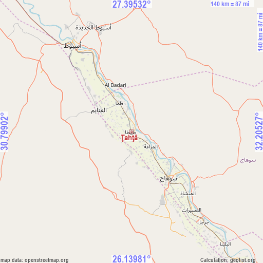
Ţahţā GPS coordinates[2]
26° 46' 9.48" North, 31° 30' 7.704" East
| Map corner | latitude | longitude |
|---|---|---|
| Upper-left | 27.39532°, | 30.79902° |
| Center: | 26.7693°, | 31.50214° |
| Lower-right: | 26.13981°, | 32.20527° |
| Map W x H: | 139.6×139.6 km | = 86.7×86.7mi |
| max Lat: | 31.5084° ⇑84.8% North |
| Ţahţā: | 26.7693° |
| min Lat: | ⇓15.2% South 22.3457° |
| min Long | Ţahţā | max Long |
| 25.51965° | 31.50214° | 34.89572° |
| W 60.1%⇐ | ⇒39.9% E |
Elevation
Elevation of Ţahţā is 66 m = 217 ft, and this is 22.5 m = 74 ft above average elevation for this country.
| Max E: |
1565 m = 5135 ft | 15.9% |
| Ţahţā | 66 m 217 ft | |
| Avg. | 43.5 m = 143 ft | |
Min E: |
-15 m = -49 ft | 84.1% |
See also: Ţahţā elevation on elevation.city.
Geographical zone
Ţahţā is located in North temperate zone (between Tropic of Cancer and the Arctic Circle). Distance of this Northern Tropic circle is 370.5 km =230.2 mi to South.| Distance of | km | miles | from Ţahţā |
|---|---|---|---|
| North Pole | 7030.6 | 4368.6 | to North |
| Arctic Circle | 4424.7 | 2749.4 | to North |
| Tropic Cancer | 370.5 | 230.2 | to South |
| Equator | 2976.5 | 1849.5 | to South |


Nearby cities:
15 places around Ţahţā: (largest is in red/bold)
• Abnūb
65.6 km =40.8 mi,  327°
327°
• Abū Tīj
35.5 km =22.1 mi, 329°
• Akhmīm
33.4 km =20.8 mi,  133°
133°
• Al Badārī
26.3 km =16.3 mi,  340°
340°
• Al Balyanā
77.5 km =48.2 mi,  139°
139°
• Al Manshāh
44.2 km =27.5 mi, 137°
• Al Qūşīyah
100.7 km =62.6 mi,  317°
317°
• Asyūţ
55.6 km =34.5 mi, 325°
• Dayrūţ
111.2 km =69.1 mi, 321°
• Farshūţ
103.2 km =64.1 mi, 140°
• Jirjā
61.6 km =38.3 mi, 141°
• Juhaynah
10.7 km =6.6 mi,  182°
182°
• Manfalūţ
80 km =49.7 mi, 318°
• Naja' Ḥammādī
108.7 km =67.5 mi, 137°
• Sohag
30.4 km =18.9 mi, 140°
Sources, notices
• [Note1] Compared only with cities in Egypt existing in our database
• [Src1] Map data: © OpenStreetMap contributors (CC-BY-SA)
• [Src2] Other city data from geonames.org with taken over terms of usage.
• [Src3] Geographical zone / Annual Mean Temperature by Robert A. Rohde @ Wikipedia
