Al Badārī geodata
Al Badārī (Asyut) is a populated place; located in Egypt in Africa/Cairo (GMT+2) time zone. With population of 44,132 people, there are 96 cities with bigger population in this country. Compared to other cities in Egypt, 83.3% of cities are located further ↑North; 55.8% of cities are located further ←West and 81.9% of cities have lower elevation than Al Badārī. Note1


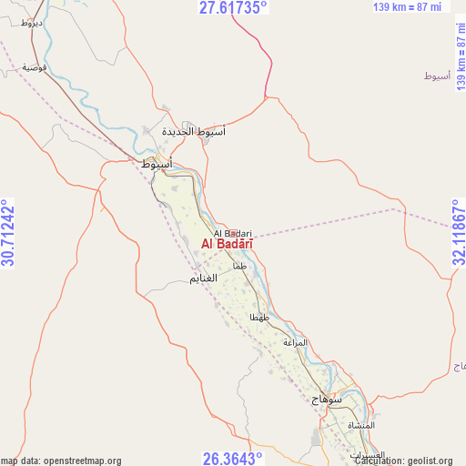
Al Badārī GPS coordinates[2]
26° 59' 33.252" North, 31° 24' 55.944" East
| Map corner | latitude | longitude |
|---|---|---|
| Upper-left | 27.61735°, | 30.71242° |
| Center: | 26.99257°, | 31.41554° |
| Lower-right: | 26.3643°, | 32.11867° |
| Map W x H: | 139.3×139.3 km | = 86.6×86.6mi |
| max Lat: | 31.5084° ⇑83.3% North |
| Al Badārī: | 26.99257° |
| min Lat: | ⇓16.7% South 22.3457° |
| min Long | Al Badārī | max Long |
| 25.51965° | 31.41554° | 34.89572° |
| W 55.8%⇐ | ⇒44.2% E |
Elevation
Elevation of Al Badārī is 63 m = 207 ft, and this is 19.5 m = 64 ft above average elevation for this country.
| Max E: |
1565 m = 5135 ft | 18.1% |
| Al Badārī | 63 m 207 ft | |
| Avg. | 43.5 m = 143 ft | |
Min E: |
-15 m = -49 ft | 81.9% |
See also: Al Badārī elevation on elevation.city.
Geographical zone
Al Badārī is located in North temperate zone (between Tropic of Cancer and the Arctic Circle). Distance of this Northern Tropic circle is 395.4 km =245.7 mi to South.| Distance of | km | miles | from Al Badārī |
|---|---|---|---|
| North Pole | 7005.8 | 4353.2 | to North |
| Arctic Circle | 4399.9 | 2734 | to North |
| Tropic Cancer | 395.4 | 245.7 | to South |
| Equator | 3001.3 | 1864.9 | to South |


Nearby cities:
15 places around Al Badārī: (largest is in red/bold)
• Abnūb
40.4 km =25.1 mi,  319°
319°
• Abū Tīj
11.2 km =7 mi,  300°
300°
• Akhmīm
58 km =36 mi,  145°
145°
• Al Balyanā
102.5 km =63.7 mi, 145°
• Al Manshāh
69.1 km =42.9 mi, 146°
• Al Qūşīyah
77.2 km =48 mi,  310°
310°
• Asyūţ
31.1 km =19.3 mi, 312°
• Dayr Mawās
91.5 km =56.9 mi, 322°
• Dayrūţ
86.8 km =53.9 mi, 316°
• Jirjā
86.8 km =53.9 mi, 146°
• Juhaynah
36.4 km =22.6 mi,  167°
167°
• Mallawī
99.8 km =62 mi,  325°
325°
• Manfalūţ
56.5 km =35.1 mi, 308°
• Sohag
55.8 km =34.7 mi, 150°
• Ţahţā
26.3 km =16.3 mi,  160°
160°
Sources, notices
• [Note1] Compared only with cities in Egypt existing in our database
• [Src1] Map data: © OpenStreetMap contributors (CC-BY-SA)
• [Src2] Other city data from geonames.org with taken over terms of usage.
• [Src3] Geographical zone / Annual Mean Temperature by Robert A. Rohde @ Wikipedia
