Al Ḩāmūl geodata
Al Ḩāmūl (Kafr el-Sheikh) is a populated place; located in Egypt in Africa/Cairo (GMT+2) time zone. With population of 45,798 people, there are 91 cities with bigger population in this country. Compared to other cities in Egypt, 96.4% of cities are located further ↓South; 62.3% of cities are located further →East and 95.7% of cities have higher elevation than Al Ḩāmūl. Note1


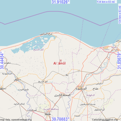
Al Ḩāmūl GPS coordinates[2]
31° 18' 41.256" North, 31° 8' 51.576" East
| Map corner | latitude | longitude |
|---|---|---|
| Upper-left | 31.91026°, | 30.44454° |
| Center: | 31.31146°, | 31.14766° |
| Lower-right: | 30.70883°, | 31.85079° |
| Map W x H: | 133.6×133.6 km | = 83×83mi |
| max Lat: | 31.5084° ⇑3.6% North |
| Al Ḩāmūl: | 31.31146° |
| min Lat: | ⇓96.4% South 22.3457° |
| min Long | Al Ḩāmūl | max Long |
| 25.51965° | 31.14766° | 34.89572° |
| W 37.7%⇐ | ⇒62.3% E |
Elevation
Elevation of Al Ḩāmūl is 5 m = 16 ft, and this is 38.5 m = 126 ft below average elevation for this country.
| Max E: |
1565 m = 5135 ft | 95.7% |
| Avg. | 43.5 m = 143 ft | |
| Al Ḩāmūl | 5 m = 16 ft | |
Min E: |
-15 m = -49 ft | 4.3% |
See also: Al Ḩāmūl elevation on elevation.city.
Geographical zone
Al Ḩāmūl is located in North temperate zone (between Tropic of Cancer and the Arctic Circle). Distance of this Northern Tropic circle is 875.6 km =544.1 mi to South.| Distance of | km | miles | from Al Ḩāmūl |
|---|---|---|---|
| North Pole | 6525.6 | 4054.8 | to North |
| Arctic Circle | 3919.7 | 2435.6 | to North |
| Tropic Cancer | 875.6 | 544.1 | to South |
| Equator | 3481.5 | 2163.3 | to South |


Nearby cities:
15 places around Al Ḩāmūl: (largest is in red/bold)
• Ajā
43.3 km =26.9 mi,  161°
161°
• Al Manşūrah
37.8 km =23.5 mi,  144°
144°
• Al Maḩallah al Kubrá
37.9 km =23.5 mi,  177°
177°
• Az Zarqā
47.7 km =29.6 mi,  103°
103°
• Bilqās
22.7 km =14.1 mi,  118°
118°
• Dikirnis
49.2 km =30.6 mi, 120°
• Disūq
51.5 km =32 mi,  247°
247°
• Kafr ash Shaykh
29.7 km =18.5 mi,  221°
221°
• Minyat an Naşr
51.4 km =31.9 mi,  113°
113°
• Munshāt ‘Alī Āghā
45.7 km =28.4 mi, 248°
• Quţūr
41.9 km =26 mi,  205°
205°
• Samannūd
39.9 km =24.8 mi,  167°
167°
• Shirbīn
38 km =23.6 mi, 109°
• Sīdī Sālim
34.6 km =21.5 mi,  262°
262°
• Ţalkhā
36.1 km =22.4 mi, 142°
Sources, notices
• [Note1] Compared only with cities in Egypt existing in our database
• [Src1] Map data: © OpenStreetMap contributors (CC-BY-SA)
• [Src2] Other city data from geonames.org with taken over terms of usage.
• [Src3] Geographical zone / Annual Mean Temperature by Robert A. Rohde @ Wikipedia
