Zújar geodata
Zújar (Andalusia) is a populated place; located in Spain in Europe/Madrid (GMT+2) time zone. With population of 2,699 people, there are 1820 cities with bigger population in this country. Compared to other cities in Spain, 91.1% of cities are located further ↑North; 56.9% of cities are located further ←West and 65.4% of cities have lower elevation than Zújar. Note1


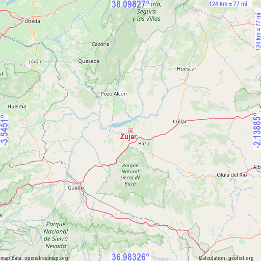
Zújar GPS coordinates[2]
37° 32' 34.26" North, 2° 50' 31.092" West
| Map corner | latitude | longitude |
|---|---|---|
| Upper-left | 38.09827°, | -3.5451° |
| Center: | 37.54285°, | -2.84197° |
| Lower-right: | 36.98326°, | -2.13885° |
| Map W x H: | 124×124 km | = 77.1×77.1mi |
| max Lat: | 43.74134° ⇑91.1% North |
| Zújar: | 37.54285° |
| min Lat: | ⇓8.9% South 27.64134° |
| min Long | Zújar | max Long |
| -18.00367° | -2.84197° | 4.2899° |
| W 56.9%⇐ | ⇒43.1% E |
Elevation
Elevation of Zújar is 780 m = 2559 ft, and this is 182 m = 597 ft above average elevation for this country.
| Max E: |
1682 m = 5518 ft | 34.6% |
| Zújar | 780 m 2559 ft | |
| Avg. | 598 m = 1962 ft | |
Min E: |
0 m = 0 ft | 65.4% |
See also: Spain elevation on elevation.city.
Geographical zone
Zújar is located in North temperate zone (between Tropic of Cancer and the Arctic Circle). Distance of this Northern Tropic circle is 1568.5 km =974.6 mi to South.| Distance of | km | miles | from Zújar |
|---|---|---|---|
| North Pole | 5832.7 | 3624.3 | to North |
| Arctic Circle | 3226.8 | 2005 | to North |
| Tropic Cancer | 1568.5 | 974.6 | to South |
| Equator | 4174.4 | 2593.9 | to South |


Nearby cities:
15 places around Zújar: (largest is in red/bold)
• Alicún de Ortega
27 km =16.8 mi,  285°
285°
• Baza
8.4 km =5.2 mi,  133°
133°
• Benamaurel
14.3 km =8.9 mi,  59°
59°
• Caniles
15.7 km =9.8 mi,  138°
138°
• Castilléjar
26.3 km =16.3 mi,  42°
42°
• Castril
28.7 km =17.8 mi,  10°
10°
• Cortes de Baza
13.9 km =8.6 mi,  26°
26°
• Cuevas del Campo
10.5 km =6.5 mi,  313°
313°
• Dehesas de Guadix
23.6 km =14.7 mi,  282°
282°
• Freila
6 km =3.7 mi,  256°
256°
• Gor
22.4 km =13.9 mi,  210°
210°
• Gorafe
19 km =11.8 mi,  248°
248°
• Hinojares
23.6 km =14.7 mi,  324°
324°
• Pozo Alcón
19.5 km =12.1 mi,  335°
335°
• Villanueva de las Torres
21.8 km =13.5 mi,  274°
274°
Sources, notices
• [Note1] Compared only with cities in Spain existing in our database
• [Src1] Map data: © OpenStreetMap contributors (CC-BY-SA)
• [Src2] Other city data from geonames.org with taken over terms of usage.
• [Src3] Geographical zone / Annual Mean Temperature by Robert A. Rohde @ Wikipedia
