Dehesas de Guadix geodata
Dehesas de Guadix (Andalusia) is a seat of a third-order administrative division; located in Spain in Europe/Madrid (GMT+2) time zone. With population of 562 people, there are 3711 cities with bigger population in this country. Compared to other cities in Spain, 90.8% of cities are located further ↑North; 52.6% of cities are located further ←West and 52.7% of cities have lower elevation than Dehesas de Guadix. Note1
Administrative division(s):
- Level 1: Andalusia
- Level 2: Provincia de Granada
- Level 3: Dehesas de Guadix


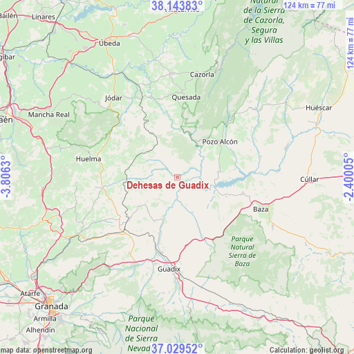
Dehesas de Guadix GPS coordinates[2]
37° 35' 19.536" North, 3° 6' 11.412" West
| Map corner | latitude | longitude |
|---|---|---|
| Upper-left | 38.14383°, | -3.8063° |
| Center: | 37.58876°, | -3.10317° |
| Lower-right: | 37.02952°, | -2.40005° |
| Map W x H: | 123.9×123.9 km | = 77×77mi |
| max Lat: | 43.74134° ⇑90.8% North |
| Dehesas de Guadix: | 37.58876° |
| min Lat: | ⇓9.2% South 27.64134° |
| min Long | Dehesas de Guad | max Long |
| -18.00367° | -3.10317° | 4.2899° |
| W 52.6%⇐ | ⇒47.4% E |
Elevation
Elevation of Dehesas de Guadix is 687 m = 2254 ft, and this is 89 m = 292 ft above average elevation for this country.
| Max E: |
1682 m = 5518 ft | 47.3% |
| Dehesas de Guadix | 687 m 2254 ft | |
| Avg. | 598 m = 1962 ft | |
Min E: |
0 m = 0 ft | 52.7% |
See also: Spain elevation on elevation.city.
Geographical zone
Dehesas de Guadix is located in North temperate zone (between Tropic of Cancer and the Arctic Circle). Distance of this Northern Tropic circle is 1573.6 km =977.8 mi to South.| Distance of | km | miles | from Dehesas de Guadix |
|---|---|---|---|
| North Pole | 5827.6 | 3621.1 | to North |
| Arctic Circle | 3221.7 | 2001.9 | to North |
| Tropic Cancer | 1573.6 | 977.8 | to South |
| Equator | 4179.5 | 2597 | to South |


Nearby cities:
15 places around Dehesas de Guadix: (largest is in red/bold)
• Alamedilla
12.3 km =7.6 mi,  266°
266°
• Alicún de Ortega
3.7 km =2.3 mi,  307°
307°
• Cabra del Santo Cristo
20.7 km =12.9 mi, 308°
• Cuevas del Campo
15.5 km =9.6 mi,  82°
82°
• Fonelas
20.7 km =12.9 mi,  196°
196°
• Freila
18.4 km =11.4 mi,  110°
110°
• Gobernador
22.8 km =14.2 mi,  237°
237°
• Gorafe
13.2 km =8.2 mi,  155°
155°
• Hinojares
16.9 km =10.5 mi,  33°
33°
• Huesa
19.7 km =12.2 mi,  6°
6°
• Huélago
23.5 km =14.6 mi,  216°
216°
• Larva
21 km =13 mi,  335°
335°
• Pedro Martínez
14.8 km =9.2 mi,  229°
229°
• Pozo Alcón
19.6 km =12.2 mi,  49°
49°
• Villanueva de las Torres
3.7 km =2.3 mi, 160°
Sources, notices
• [Note1] Compared only with cities in Spain existing in our database
• [Src1] Map data: © OpenStreetMap contributors (CC-BY-SA)
• [Src2] Other city data from geonames.org with taken over terms of usage.
• [Src3] Geographical zone / Annual Mean Temperature by Robert A. Rohde @ Wikipedia
