Gor geodata
Gor (Andalusia) is a seat of a third-order administrative division; located in Spain in Europe/Madrid (GMT+2) time zone. With population of 1,025 people, there are 2906 cities with bigger population in this country. Compared to other cities in Spain, 92.3% of cities are located further ↑North; 54.9% of cities are located further ←West and 97.8% of cities have lower elevation than Gor. Note1


Gor GPS coordinates[2]
37° 22' 9.732" North, 2° 58' 12.576" West
| Map corner | latitude | longitude |
|---|---|---|
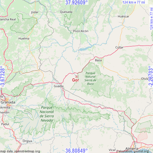
| Upper-left | 37.92609°, | -3.67328° |
| Center: | 37.36937°, | -2.97016° |
| Lower-right: | 36.80849°, | -2.26703° |
| Map W x H: | 124.3×124.3 km | = 77.2×77.2mi |
| max Lat: | 43.74134° ⇑92.3% North |
| Gor: | 37.36937° |
| min Lat: | ⇓7.7% South 27.64134° |
| min Long | Gor | max Long |
| -18.00367° | -2.97016° | 4.2899° |
| W 54.9%⇐ | ⇒45.1% E |
Elevation
Elevation of Gor is 1242 m = 4075 ft, and this is 644 m = 2113 ft above average elevation for this country.
| Max E: |
1682 m = 5518 ft | 2.2% |
| Gor | 1242 m 4075 ft | |
| Avg. | 598 m = 1962 ft | |
Min E: |
0 m = 0 ft | 97.8% |
See also: Spain elevation on elevation.city.
Geographical zone
Gor is located in North temperate zone (between Tropic of Cancer and the Arctic Circle). Distance of this Northern Tropic circle is 1549.2 km =962.6 mi to South.| Distance of | km | miles | from Gor |
|---|---|---|---|
| North Pole | 5852 | 3636.3 | to North |
| Arctic Circle | 3246.1 | 2017 | to North |
| Tropic Cancer | 1549.2 | 962.6 | to South |
| Equator | 4155.1 | 2581.9 | to South |


Nearby cities:
15 places around Gor: (largest is in red/bold)
• Albuñán
21.4 km =13.3 mi,  222°
222°
• Baza
22.1 km =13.7 mi,  52°
52°
• Beas de Guadix
23.1 km =14.4 mi,  244°
244°
• Benalúa de Guadix
17.2 km =10.7 mi,  263°
263°
• Caniles
22.9 km =14.2 mi,  70°
70°
• Dólar
21.2 km =13.2 mi,  185°
185°
• Ferreira
22.6 km =14 mi, 194°
• Fonelas
18.4 km =11.4 mi,  284°
284°
• Freila
18.7 km =11.6 mi,  17°
17°
• Gorafe
13.9 km =8.6 mi,  332°
332°
• Guadix
16.9 km =10.5 mi, 242°
• Huéneja
21.5 km =13.4 mi,  175°
175°
• Marchal
22.2 km =13.8 mi,  248°
248°
• Purullena
20.3 km =12.6 mi, 253°
• Zújar
22.4 km =13.9 mi,  30°
30°
Sources, notices
• [Note1] Compared only with cities in Spain existing in our database
• [Src1] Map data: © OpenStreetMap contributors (CC-BY-SA)
• [Src2] Other city data from geonames.org with taken over terms of usage.
• [Src3] Geographical zone / Annual Mean Temperature by Robert A. Rohde @ Wikipedia
