Yeste geodata
Yeste (Castille-La Mancha) is a seat of a third-order administrative division; located in Spain in Europe/Madrid (GMT+2) time zone. With population of 3,580 people, there are 1569 cities with bigger population in this country. Compared to other cities in Spain, 86.4% of cities are located further ↑North; 63.2% of cities are located further ←West and 81.5% of cities have lower elevation than Yeste. Note1
Administrative division(s):
- Level 1: Castille-La Mancha
- Level 2: Provincia de Albacete
- Level 3: Yeste


Yeste GPS coordinates[2]
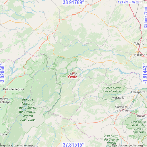
38° 22' 6.672" North, 2° 19' 3.216" West
| Map corner | latitude | longitude |
|---|---|---|
| Upper-left | 38.91769°, | -3.02068° |
| Center: | 38.36852°, | -2.31756° |
| Lower-right: | 37.81515°, | -1.61443° |
| Map W x H: | 122.6×122.6 km | = 76.2×76.2mi |
| max Lat: | 43.74134° ⇑86.4% North |
| Yeste: | 38.36852° |
| min Lat: | ⇓13.6% South 27.64134° |
| min Long | Yeste | max Long |
| -18.00367° | -2.31756° | 4.2899° |
| W 63.2%⇐ | ⇒36.8% E |
Elevation
Elevation of Yeste is 912 m = 2992 ft, and this is 314 m = 1030 ft above average elevation for this country.
| Max E: |
1682 m = 5518 ft | 18.5% |
| Yeste | 912 m 2992 ft | |
| Avg. | 598 m = 1962 ft | |
Min E: |
0 m = 0 ft | 81.5% |
See also: Spain elevation on elevation.city.
Geographical zone
Yeste is located in North temperate zone (between Tropic of Cancer and the Arctic Circle). Distance of this Northern Tropic circle is 1660.3 km =1031.7 mi to South.| Distance of | km | miles | from Yeste |
|---|---|---|---|
| North Pole | 5740.9 | 3567.2 | to North |
| Arctic Circle | 3135 | 1948 | to North |
| Tropic Cancer | 1660.3 | 1031.7 | to South |
| Equator | 4266.2 | 2650.9 | to South |


Nearby cities:
15 places around Yeste: (largest is in red/bold)
• Ayna
28.7 km =17.8 mi,  45°
45°
• Benatae
29.1 km =18.1 mi,  266°
266°
• Bogarra
25.4 km =15.8 mi,  21°
21°
• Cotillas
17.8 km =11.1 mi,  293°
293°
• Elche de la Sierra
25.3 km =15.7 mi,  68°
68°
• Férez
27.8 km =17.3 mi,  94°
94°
• Letur
18.8 km =11.7 mi, 90°
• Molinicos
12.9 km =8 mi,  31°
31°
• Nerpio
24.6 km =15.3 mi,  176°
176°
• Paterna del Madera
25.6 km =15.9 mi,  354°
354°
• Riópar
18.6 km =11.6 mi,  321°
321°
• Segura de la Sierra
30.2 km =18.8 mi,  254°
254°
• Siles
23.2 km =14.4 mi,  275°
275°
• Socovos
29.3 km =18.2 mi,  97°
97°
• Villaverde de Guadalimar
19.9 km =12.4 mi,  298°
298°
Sources, notices
• [Note1] Compared only with cities in Spain existing in our database
• [Src1] Map data: © OpenStreetMap contributors (CC-BY-SA)
• [Src2] Other city data from geonames.org with taken over terms of usage.
• [Src3] Geographical zone / Annual Mean Temperature by Robert A. Rohde @ Wikipedia
