Ayna geodata
Ayna (Castille-La Mancha) is a seat of a third-order administrative division; located in Spain in Europe/Madrid (GMT+2) time zone. With population of 943 people, there are 3022 cities with bigger population in this country. Compared to other cities in Spain, 85.3% of cities are located further ↑North; 66.4% of cities are located further ←West and 55.4% of cities have lower elevation than Ayna. Note1
Administrative division(s):
- Level 1: Castille-La Mancha
- Level 2: Provincia de Albacete
- Level 3: Ayna


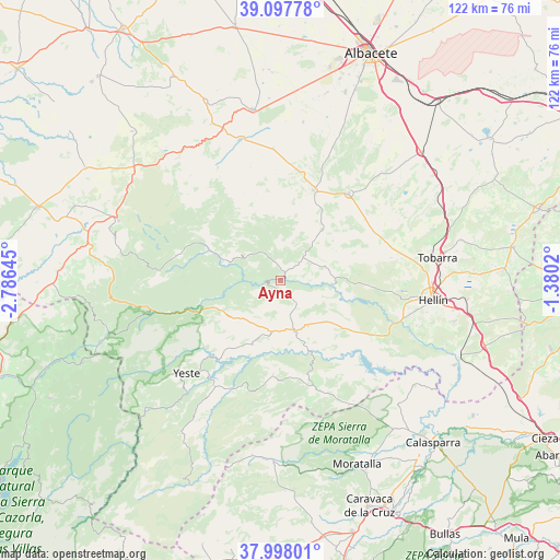
Ayna GPS coordinates[2]
38° 33' 0" North, 2° 4' 59.988" West
| Map corner | latitude | longitude |
|---|---|---|
| Upper-left | 39.09778°, | -2.78645° |
| Center: | 38.55°, | -2.08333° |
| Lower-right: | 37.99801°, | -1.3802° |
| Map W x H: | 122.3×122.3 km | = 76×76mi |
| max Lat: | 43.74134° ⇑85.3% North |
| Ayna: | 38.55° |
| min Lat: | ⇓14.7% South 27.64134° |
| min Long | Ayna | max Long |
| -18.00367° | -2.08333° | 4.2899° |
| W 66.4%⇐ | ⇒33.6% E |
Elevation
Elevation of Ayna is 712 m = 2336 ft, and this is 114 m = 374 ft above average elevation for this country.
| Max E: |
1682 m = 5518 ft | 44.6% |
| Ayna | 712 m 2336 ft | |
| Avg. | 598 m = 1962 ft | |
Min E: |
0 m = 0 ft | 55.4% |
See also: Spain elevation on elevation.city.
Geographical zone
Ayna is located in North temperate zone (between Tropic of Cancer and the Arctic Circle). Distance of this Northern Tropic circle is 1680.4 km =1044.2 mi to South.| Distance of | km | miles | from Ayna |
|---|---|---|---|
| North Pole | 5720.7 | 3554.7 | to North |
| Arctic Circle | 3114.8 | 1935.4 | to North |
| Tropic Cancer | 1680.4 | 1044.2 | to South |
| Equator | 4286.4 | 2663.4 | to South |


Nearby cities:
15 places around Ayna: (largest is in red/bold)
• Alcadozo
14.2 km =8.8 mi,  39°
39°
• Bogarra
11.8 km =7.3 mi,  287°
287°
• Casas de Lázaro
28.1 km =17.5 mi,  330°
330°
• Elche de la Sierra
11.4 km =7.1 mi,  164°
164°
• Férez
23.4 km =14.5 mi, 161°
• Letur
20.5 km =12.7 mi,  184°
184°
• Liétor
11.3 km =7 mi,  94°
94°
• Masegoso
27.6 km =17.1 mi,  312°
312°
• Molinicos
16.4 km =10.2 mi,  235°
235°
• Paterna del Madera
23.3 km =14.5 mi,  283°
283°
• Peñas de San Pedro
21 km =13 mi,  18°
18°
• Pozohondo
24.1 km =15 mi, 38°
• Pozuelo
28.9 km =18 mi,  356°
356°
• Socovos
25.7 km =16 mi, 160°
• Yeste
28.7 km =17.8 mi,  225°
225°
Sources, notices
• [Note1] Compared only with cities in Spain existing in our database
• [Src1] Map data: © OpenStreetMap contributors (CC-BY-SA)
• [Src2] Other city data from geonames.org with taken over terms of usage.
• [Src3] Geographical zone / Annual Mean Temperature by Robert A. Rohde @ Wikipedia
