Cotillas geodata
Cotillas (Castille-La Mancha) is a seat of a third-order administrative division; located in Spain in Europe/Madrid (GMT+2) time zone. With population of 163 people, there are 5323 cities with bigger population in this country. Compared to other cities in Spain, 86% of cities are located further ↑North; 60.9% of cities are located further ←West and 83.7% of cities have lower elevation than Cotillas. Note1
Administrative division(s):
- Level 1: Castille-La Mancha
- Level 2: Provincia de Albacete
- Level 3: Cotillas


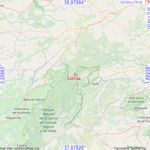
Cotillas GPS coordinates[2]
38° 25' 52.14" North, 2° 30' 19.8" West
| Map corner | latitude | longitude |
|---|---|---|
| Upper-left | 38.97984°, | -3.20863° |
| Center: | 38.43115°, | -2.5055° |
| Lower-right: | 37.87826°, | -1.80238° |
| Map W x H: | 122.5×122.5 km | = 76.1×76.1mi |
| max Lat: | 43.74134° ⇑86% North |
| Cotillas: | 38.43115° |
| min Lat: | ⇓14% South 27.64134° |
| min Long | Cotillas | max Long |
| -18.00367° | -2.5055° | 4.2899° |
| W 60.9%⇐ | ⇒39.1% E |
Elevation
Elevation of Cotillas is 936 m = 3071 ft, and this is 338 m = 1109 ft above average elevation for this country.
| Max E: |
1682 m = 5518 ft | 16.3% |
| Cotillas | 936 m 3071 ft | |
| Avg. | 598 m = 1962 ft | |
Min E: |
0 m = 0 ft | 83.7% |
See also: Spain elevation on elevation.city.
Geographical zone
Cotillas is located in North temperate zone (between Tropic of Cancer and the Arctic Circle). Distance of this Northern Tropic circle is 1667.2 km =1035.9 mi to South.| Distance of | km | miles | from Cotillas |
|---|---|---|---|
| North Pole | 5733.9 | 3562.9 | to North |
| Arctic Circle | 3128 | 1943.6 | to North |
| Tropic Cancer | 1667.2 | 1035.9 | to South |
| Equator | 4273.1 | 2655.2 | to South |


Nearby cities:
15 places around Cotillas: (largest is in red/bold)
• Benatae
15.4 km =9.6 mi,  235°
235°
• Bienservida
13.3 km =8.3 mi,  316°
316°
• Génave
19.8 km =12.3 mi,  269°
269°
• La Puerta de Segura
22.2 km =13.8 mi,  246°
246°
• Molinicos
23.5 km =14.6 mi,  80°
80°
• Orcera
18.8 km =11.7 mi,  227°
227°
• Paterna del Madera
23.2 km =14.4 mi,  37°
37°
• Riópar
9.1 km =5.7 mi,  32°
32°
• Salobre
18.4 km =11.4 mi,  347°
347°
• Segura de la Sierra
19.6 km =12.2 mi,  220°
220°
• Siles
8.1 km =5 mi, 235°
• Torres de Albanchez
15.1 km =9.4 mi,  263°
263°
• Villapalacios
19.5 km =12.1 mi,  325°
325°
• Villaverde de Guadalimar
2.9 km =1.8 mi,  338°
338°
• Yeste
17.8 km =11.1 mi,  113°
113°
Sources, notices
• [Note1] Compared only with cities in Spain existing in our database
• [Src1] Map data: © OpenStreetMap contributors (CC-BY-SA)
• [Src2] Other city data from geonames.org with taken over terms of usage.
• [Src3] Geographical zone / Annual Mean Temperature by Robert A. Rohde @ Wikipedia
