Villar de Rena geodata
Villar de Rena (Extremadura) is a seat of a third-order administrative division; located in Spain in Europe/Madrid (GMT+2) time zone. With population of 1,540 people, there are 2432 cities with bigger population in this country. Compared to other cities in Spain, 80.4% of cities are located further ↑North; 83.4% of cities are located further →East and 77% of cities have higher elevation than Villar de Rena. Note1
Administrative division(s):
- Level 1: Extremadura
- Level 2: Provincia de Badajoz
- Level 3: Villar de Rena


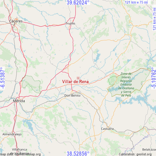
Villar de Rena GPS coordinates[2]
39° 4' 35.436" North, 5° 48' 38.664" West
| Map corner | latitude | longitude |
|---|---|---|
| Upper-left | 39.62024°, | -6.51387° |
| Center: | 39.07651°, | -5.81074° |
| Lower-right: | 38.52856°, | -5.10762° |
| Map W x H: | 121.4×121.4 km | = 75.4×75.4mi |
| max Lat: | 43.74134° ⇑80.4% North |
| Villar de Rena: | 39.07651° |
| min Lat: | ⇓19.6% South 27.64134° |
| min Long | Villar de Rena | max Long |
| -18.00367° | -5.81074° | 4.2899° |
| W 16.6%⇐ | ⇒83.4% E |
Elevation
Elevation of Villar de Rena is 269 m = 883 ft, and this is 329 m = 1079 ft below average elevation for this country.
| Max E: |
1682 m = 5518 ft | 77% |
| Avg. | 598 m = 1962 ft | |
| Villar de Rena | 269 m = 883 ft | |
Min E: |
0 m = 0 ft | 23% |
See also: Spain elevation on elevation.city.
Geographical zone
Villar de Rena is located in North temperate zone (between Tropic of Cancer and the Arctic Circle). Distance of this Northern Tropic circle is 1739 km =1080.6 mi to South.| Distance of | km | miles | from Villar de Rena |
|---|---|---|---|
| North Pole | 5662.2 | 3518.3 | to North |
| Arctic Circle | 3056.3 | 1899.1 | to North |
| Tropic Cancer | 1739 | 1080.6 | to South |
| Equator | 4344.9 | 2699.8 | to South |


Nearby cities:
15 places around Villar de Rena: (largest is in red/bold)
• Abertura
18.6 km =11.6 mi,  359°
359°
• Acedera
20.4 km =12.7 mi,  89°
89°
• Alcollarín
19.7 km =12.2 mi,  18°
18°
• Don Benito
14.1 km =8.8 mi,  198°
198°
• Escurial
12.1 km =7.5 mi,  328°
328°
• La Haba
17.5 km =10.9 mi,  177°
177°
• Madrigalejo
17.3 km =10.7 mi,  66°
66°
• Magacela
21.1 km =13.1 mi,  161°
161°
• Medellín
17.9 km =11.1 mi,  225°
225°
• Mengabril
18.9 km =11.7 mi,  214°
214°
• Miajadas
11.8 km =7.3 mi,  314°
314°
• Rena
2.7 km =1.7 mi, 176°
• Santa Amalia
18.8 km =11.7 mi,  247°
247°
• Villamesías
19.6 km =12.2 mi,  344°
344°
• Villanueva de la Serena
11.2 km =7 mi,  174°
174°
Sources, notices
• [Note1] Compared only with cities in Spain existing in our database
• [Src1] Map data: © OpenStreetMap contributors (CC-BY-SA)
• [Src2] Other city data from geonames.org with taken over terms of usage.
• [Src3] Geographical zone / Annual Mean Temperature by Robert A. Rohde @ Wikipedia
