Ugíjar geodata
Ugíjar (Andalusia) is a seat of a third-order administrative division; located in Spain in Europe/Madrid (GMT+2) time zone. With population of 2,546 people, there are 1886 cities with bigger population in this country. Compared to other cities in Spain, 95.6% of cities are located further ↑North; 53.5% of cities are located further ←West and 58.5% of cities have higher elevation than Ugíjar. Note1


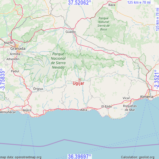
Ugíjar GPS coordinates[2]
36° 57' 39.132" North, 3° 3' 18.828" West
| Map corner | latitude | longitude |
|---|---|---|
| Upper-left | 37.52062°, | -3.75835° |
| Center: | 36.96087°, | -3.05523° |
| Lower-right: | 36.39697°, | -2.3521° |
| Map W x H: | 124.9×124.9 km | = 77.6×77.6mi |
| max Lat: | 43.74134° ⇑95.6% North |
| Ugíjar: | 36.96087° |
| min Lat: | ⇓4.4% South 27.64134° |
| min Long | Ugíjar | max Long |
| -18.00367° | -3.05523° | 4.2899° |
| W 53.5%⇐ | ⇒46.5% E |
Elevation
Elevation of Ugíjar is 548 m = 1798 ft, and this is 50 m = 164 ft below average elevation for this country.
| Max E: |
1682 m = 5518 ft | 58.5% |
| Avg. | 598 m = 1962 ft | |
| Ugíjar | 548 m = 1798 ft | |
Min E: |
0 m = 0 ft | 41.5% |
See also: Spain elevation on elevation.city.
Geographical zone
Ugíjar is located in North temperate zone (between Tropic of Cancer and the Arctic Circle). Distance of this Northern Tropic circle is 1503.7 km =934.4 mi to South.| Distance of | km | miles | from Ugíjar |
|---|---|---|---|
| North Pole | 5897.4 | 3664.5 | to North |
| Arctic Circle | 3291.5 | 2045.2 | to North |
| Tropic Cancer | 1503.7 | 934.4 | to South |
| Equator | 4109.7 | 2553.6 | to South |


Nearby cities:
15 places around Ugíjar: (largest is in red/bold)
• Alcolea
8.5 km =5.3 mi,  79°
79°
• Bayárcal
9.4 km =5.8 mi,  34°
34°
• Berja
15.8 km =9.8 mi,  143°
143°
• Bérchules
12.2 km =7.6 mi,  278°
278°
• Cádiar
11.2 km =7 mi,  261°
261°
• Cástaras
18 km =11.2 mi, 259°
• Darrícal
5.1 km =3.2 mi,  153°
153°
• Fondón
17.5 km =10.9 mi, 82°
• Juviles
15.2 km =9.4 mi, 264°
• Laujar de Andarax
15.1 km =9.4 mi, 75°
• Lobras
14.4 km =8.9 mi, 255°
• Murtas
9.7 km =6 mi,  209°
209°
• Paterna del Río
11.3 km =7 mi,  52°
52°
• Trevélez
19.2 km =11.9 mi, 283°
• Válor
4.6 km =2.9 mi,  327°
327°
Sources, notices
• [Note1] Compared only with cities in Spain existing in our database
• [Src1] Map data: © OpenStreetMap contributors (CC-BY-SA)
• [Src2] Other city data from geonames.org with taken over terms of usage.
• [Src3] Geographical zone / Annual Mean Temperature by Robert A. Rohde @ Wikipedia
