Torre de Miguel Sesmero geodata
Torre de Miguel Sesmero (Extremadura) is a seat of a third-order administrative division; located in Spain in Europe/Madrid (GMT+2) time zone. With population of 1,197 people, there are 2726 cities with bigger population in this country. Compared to other cities in Spain, 84.8% of cities are located further ↑North; 93.5% of cities are located further →East and 73.6% of cities have higher elevation than Torre de Miguel Sesmero. Note1
Administrative division(s):
- Level 1: Extremadura
- Level 2: Provincia de Badajoz
- Level 3: Torre de Miguel Sesmero
Current local time in Torre de Miguel Sesmero:
10:49 PM, ThursdayDifference from your time zone: hours


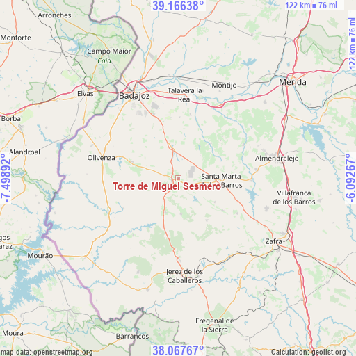
Torre de Miguel Sesmero GPS coordinates[2]
38° 37' 8.868" North, 6° 47' 44.88" West
| Map corner | latitude | longitude |
|---|---|---|
| Upper-left | 39.16638°, | -7.49892° |
| Center: | 38.61913°, | -6.7958° |
| Lower-right: | 38.06767°, | -6.09267° |
| Map W x H: | 122.2×122.2 km | = 75.9×75.9mi |
| max Lat: | 43.74134° ⇑84.8% North |
| Torre de Miguel Sesmero: | 38.61913° |
| min Lat: | ⇓15.2% South 27.64134° |
| min Long | Torre de Miguel | max Long |
| -18.00367° | -6.7958° | 4.2899° |
| W 6.5%⇐ | ⇒93.5% E |
Elevation
Elevation of Torre de Miguel Sesmero is 322 m = 1056 ft, and this is 276 m = 906 ft below average elevation for this country.
| Max E: |
1682 m = 5518 ft | 73.6% |
| Avg. | 598 m = 1962 ft | |
| Torre de Miguel Sesmero | 322 m = 1056 ft | |
Min E: |
0 m = 0 ft | 26.4% |
See also: Spain elevation on elevation.city.
Geographical zone
Torre de Miguel Sesmero is located in North temperate zone (between Tropic of Cancer and the Arctic Circle). Distance of this Northern Tropic circle is 1688.1 km =1048.9 mi to South.| Distance of | km | miles | from Torre de Miguel Sesmero |
|---|---|---|---|
| North Pole | 5713 | 3549.9 | to North |
| Arctic Circle | 3107.1 | 1930.7 | to North |
| Tropic Cancer | 1688.1 | 1048.9 | to South |
| Equator | 4294 | 2668.2 | to South |


Nearby cities:
15 places around Torre de Miguel Sesmero: (largest is in red/bold)
• Almendral
2.3 km =1.4 mi,  255°
255°
• Barcarrota
12.5 km =7.8 mi,  201°
201°
• Corte de Peleas
16.1 km =10 mi,  42°
42°
• Entrín Bajo
13.2 km =8.2 mi,  32°
32°
• Feria
23.4 km =14.5 mi,  120°
120°
• Higuera de Vargas
24.7 km =15.3 mi,  219°
219°
• La Albuera
11.2 km =7 mi,  347°
347°
• La Morera
14.9 km =9.3 mi, 123°
• La Parra
18.6 km =11.6 mi,  125°
125°
• Nogales
5.5 km =3.4 mi, 131°
• Salvaleón
12.1 km =7.5 mi,  176°
176°
• Salvatierra de los Barros
17.2 km =10.7 mi,  145°
145°
• Santa Marta
14.6 km =9.1 mi,  92°
92°
• Táliga
21.7 km =13.5 mi,  242°
242°
• Valverde de Leganés
17 km =10.6 mi,  289°
289°
Sources, notices
• [Note1] Compared only with cities in Spain existing in our database
• [Src1] Map data: © OpenStreetMap contributors (CC-BY-SA)
• [Src2] Other city data from geonames.org with taken over terms of usage.
• [Src3] Geographical zone / Annual Mean Temperature by Robert A. Rohde @ Wikipedia
