Higuera de Vargas geodata
Higuera de Vargas (Extremadura) is a seat of a third-order administrative division; located in Spain in Europe/Madrid (GMT+2) time zone. With population of 2,168 people, there are 2070 cities with bigger population in this country. Compared to other cities in Spain, 85.9% of cities are located further ↑North; 94.2% of cities are located further →East and 71.4% of cities have higher elevation than Higuera de Vargas. Note1
Administrative division(s):
- Level 1: Extremadura
- Level 2: Provincia de Badajoz
- Level 3: Higuera de Vargas


Higuera de Vargas GPS coordinates[2]
38° 26' 49.2" North, 6° 58' 30.612" West
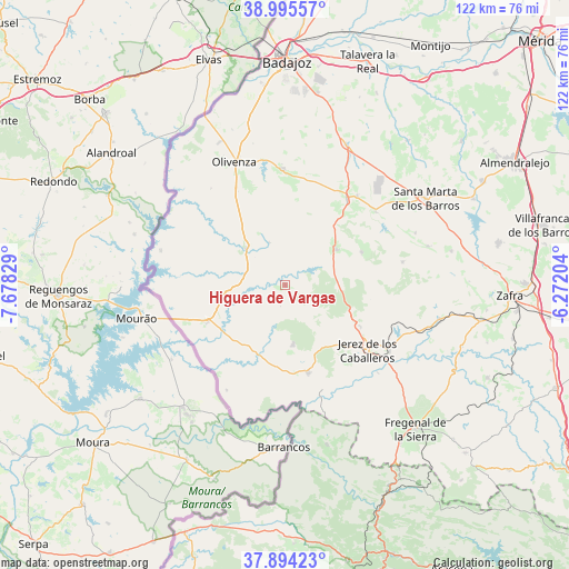
| Map corner | latitude | longitude |
|---|---|---|
| Upper-left | 38.99557°, | -7.67829° |
| Center: | 38.447°, | -6.97517° |
| Lower-right: | 37.89423°, | -6.27204° |
| Map W x H: | 122.5×122.5 km | = 76.1×76.1mi |
| max Lat: | 43.74134° ⇑85.9% North |
| Higuera de Vargas: | 38.447° |
| min Lat: | ⇓14.1% South 27.64134° |
| min Long | Higuera de Varg | max Long |
| -18.00367° | -6.97517° | 4.2899° |
| W 5.8%⇐ | ⇒94.2% E |
Elevation
Elevation of Higuera de Vargas is 358 m = 1175 ft, and this is 240 m = 787 ft below average elevation for this country.
| Max E: |
1682 m = 5518 ft | 71.4% |
| Avg. | 598 m = 1962 ft | |
| Higuera de Vargas | 358 m = 1175 ft | |
Min E: |
0 m = 0 ft | 28.6% |
See also: Spain elevation on elevation.city.
Geographical zone
Higuera de Vargas is located in North temperate zone (between Tropic of Cancer and the Arctic Circle). Distance of this Northern Tropic circle is 1669 km =1037.1 mi to South.| Distance of | km | miles | from Higuera de Vargas |
|---|---|---|---|
| North Pole | 5732.2 | 3561.8 | to North |
| Arctic Circle | 3126.3 | 1942.6 | to North |
| Tropic Cancer | 1669 | 1037.1 | to South |
| Equator | 4274.9 | 2656.3 | to South |


Nearby cities:
15 places around Higuera de Vargas: (largest is in red/bold)
• Alconchel
11.4 km =7.1 mi,  312°
312°
• Almendral
22.9 km =14.2 mi,  35°
35°
• Barcarrota
13.3 km =8.3 mi,  55°
55°
• Jerez de los Caballeros
22.6 km =14 mi,  128°
128°
• Nogales
25 km =15.5 mi,  51°
51°
• Oliva de la Frontera
19.6 km =12.2 mi,  165°
165°
• Salvaleón
17.9 km =11.1 mi,  66°
66°
• Salvatierra de los Barros
25.8 km =16 mi,  79°
79°
• Torre de Miguel Sesmero
24.7 km =15.3 mi, 39°
• Táliga
9.8 km =6.1 mi,  338°
338°
• Valle de Matamoros
16.7 km =10.4 mi,  116°
116°
• Valle de Santa Ana
18.6 km =11.6 mi, 118°
• Valverde de Leganés
24.9 km =15.5 mi,  358°
358°
• Villanueva del Fresno
18.5 km =11.5 mi,  244°
244°
• Zahinos
13 km =8.1 mi, 172°
Sources, notices
• [Note1] Compared only with cities in Spain existing in our database
• [Src1] Map data: © OpenStreetMap contributors (CC-BY-SA)
• [Src2] Other city data from geonames.org with taken over terms of usage.
• [Src3] Geographical zone / Annual Mean Temperature by Robert A. Rohde @ Wikipedia
