Torralba de Oropesa geodata
Torralba de Oropesa (Castille-La Mancha) is a seat of a third-order administrative division; located in Spain in Europe/Madrid (GMT+2) time zone. With population of 267 people, there are 4649 cities with bigger population in this country. Compared to other cities in Spain, 71.2% of cities are located further ↑North; 74.5% of cities are located further →East and 70.7% of cities have higher elevation than Torralba de Oropesa. Note1
Administrative division(s):
- Level 1: Castille-La Mancha
- Level 2: Province of Toledo
- Level 3: Torralba de Oropesa


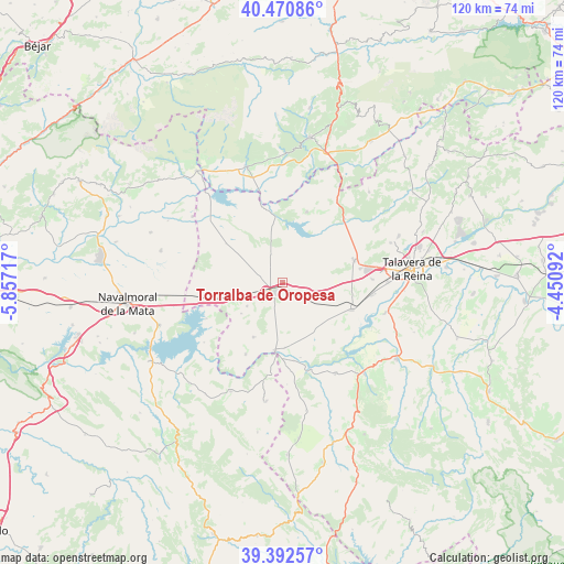
Torralba de Oropesa GPS coordinates[2]
39° 56' 1.824" North, 5° 9' 14.544" West
| Map corner | latitude | longitude |
|---|---|---|
| Upper-left | 40.47086°, | -5.85717° |
| Center: | 39.93384°, | -5.15404° |
| Lower-right: | 39.39257°, | -4.45092° |
| Map W x H: | 119.9×119.9 km | = 74.5×74.5mi |
| max Lat: | 43.74134° ⇑71.2% North |
| Torralba de Oropesa: | 39.93384° |
| min Lat: | ⇓28.8% South 27.64134° |
| min Long | Torralba de Oro | max Long |
| -18.00367° | -5.15404° | 4.2899° |
| W 25.5%⇐ | ⇒74.5% E |
Elevation
Elevation of Torralba de Oropesa is 371 m = 1217 ft, and this is 227 m = 745 ft below average elevation for this country.
| Max E: |
1682 m = 5518 ft | 70.7% |
| Avg. | 598 m = 1962 ft | |
| Torralba de Oropesa | 371 m = 1217 ft | |
Min E: |
0 m = 0 ft | 29.3% |
See also: Spain elevation on elevation.city.
Geographical zone
Torralba de Oropesa is located in North temperate zone (between Tropic of Cancer and the Arctic Circle). Distance of this Northern Tropic circle is 1834.3 km =1139.8 mi to South.| Distance of | km | miles | from Torralba de Oropesa |
|---|---|---|---|
| North Pole | 5566.8 | 3459 | to North |
| Arctic Circle | 2960.9 | 1839.8 | to North |
| Tropic Cancer | 1834.3 | 1139.8 | to South |
| Equator | 4440.2 | 2759 | to South |


Nearby cities:
15 places around Torralba de Oropesa: (largest is in red/bold)
• Alcañizo
5.3 km =3.3 mi,  129°
129°
• Alcolea de Tajo
13.8 km =8.6 mi,  177°
177°
• Azután
16.6 km =10.3 mi,  172°
172°
• Calera y Chozas
15.7 km =9.8 mi,  111°
111°
• Caleruela
11 km =6.8 mi,  233°
233°
• El Puente del Arzobispo
14.8 km =9.2 mi,  185°
185°
• Gamonal
16.7 km =10.4 mi,  79°
79°
• Herreruela de Oropesa
9 km =5.6 mi,  236°
236°
• La Calzada de Oropesa
11.3 km =7 mi,  249°
249°
• Lagartera
5.1 km =3.2 mi, 232°
• Navalcán
16 km =9.9 mi,  22°
22°
• Oropesa
2.5 km =1.6 mi,  222°
222°
• Parrillas
16.2 km =10.1 mi,  28°
28°
• Torrico
13.1 km =8.1 mi,  207°
207°
• Velada
15.9 km =9.9 mi,  72°
72°
Sources, notices
• [Note1] Compared only with cities in Spain existing in our database
• [Src1] Map data: © OpenStreetMap contributors (CC-BY-SA)
• [Src2] Other city data from geonames.org with taken over terms of usage.
• [Src3] Geographical zone / Annual Mean Temperature by Robert A. Rohde @ Wikipedia
