Velada geodata
Velada (Castille-La Mancha) is a seat of a third-order administrative division; located in Spain in Europe/Madrid (GMT+2) time zone. With population of 2,429 people, there are 1929 cities with bigger population in this country. Compared to other cities in Spain, 70.6% of cities are located further ↑North; 72.2% of cities are located further →East and 66.9% of cities have higher elevation than Velada. Note1


Velada GPS coordinates[2]
39° 58' 36.732" North, 4° 58' 35.076" West
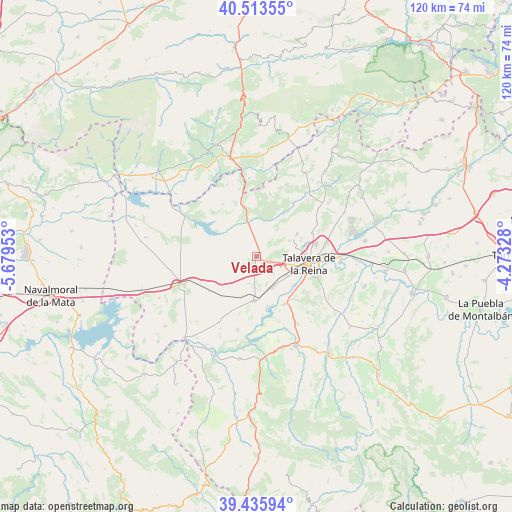
| Map corner | latitude | longitude |
|---|---|---|
| Upper-left | 40.51355°, | -5.67953° |
| Center: | 39.97687°, | -4.97641° |
| Lower-right: | 39.43594°, | -4.27328° |
| Map W x H: | 119.8×119.8 km | = 74.4×74.4mi |
| max Lat: | 43.74134° ⇑70.6% North |
| Velada: | 39.97687° |
| min Lat: | ⇓29.4% South 27.64134° |
| min Long | Velada | max Long |
| -18.00367° | -4.97641° | 4.2899° |
| W 27.8%⇐ | ⇒72.2% E |
Elevation
Elevation of Velada is 434 m = 1424 ft, and this is 164 m = 538 ft below average elevation for this country.
| Max E: |
1682 m = 5518 ft | 66.9% |
| Avg. | 598 m = 1962 ft | |
| Velada | 434 m = 1424 ft | |
Min E: |
0 m = 0 ft | 33.1% |
See also: Spain elevation on elevation.city.
Geographical zone
Velada is located in North temperate zone (between Tropic of Cancer and the Arctic Circle). Distance of this Northern Tropic circle is 1839.1 km =1142.8 mi to South.| Distance of | km | miles | from Velada |
|---|---|---|---|
| North Pole | 5562.1 | 3456.1 | to North |
| Arctic Circle | 2956.2 | 1836.9 | to North |
| Tropic Cancer | 1839.1 | 1142.8 | to South |
| Equator | 4445 | 2762 | to South |


Nearby cities:
15 places around Velada: (largest is in red/bold)
• Alcañizo
13.7 km =8.5 mi,  233°
233°
• Calera y Chozas
10.5 km =6.5 mi,  182°
182°
• Cervera de los Montes
16.4 km =10.2 mi,  59°
59°
• Gamonal
2.2 km =1.4 mi,  145°
145°
• Lagartera
20.8 km =12.9 mi,  247°
247°
• Las Herencias
12.9 km =8 mi,  159°
159°
• Mejorada
8.6 km =5.3 mi, 64°
• Montesclaros
14.8 km =9.2 mi,  12°
12°
• Navalcán
13.5 km =8.4 mi,  317°
317°
• Oropesa
18.1 km =11.2 mi, 248°
• Parrillas
12.1 km =7.5 mi, 321°
• Segurilla
10.9 km =6.8 mi, 61°
• Sotillo de las Palomas
19 km =11.8 mi,  42°
42°
• Talavera de la Reina
12.5 km =7.8 mi,  96°
96°
• Torralba de Oropesa
15.9 km =9.9 mi, 252°
Sources, notices
• [Note1] Compared only with cities in Spain existing in our database
• [Src1] Map data: © OpenStreetMap contributors (CC-BY-SA)
• [Src2] Other city data from geonames.org with taken over terms of usage.
• [Src3] Geographical zone / Annual Mean Temperature by Robert A. Rohde @ Wikipedia
