Sollana geodata
Sollana (Valencia) is a seat of a third-order administrative division; located in Spain in Europe/Madrid (GMT+2) time zone. With population of 4,515 people, there are 1381 cities with bigger population in this country. Compared to other cities in Spain, 78.8% of cities are located further ↑North; 83.4% of cities are located further ←West and 99.2% of cities have higher elevation than Sollana. Note1


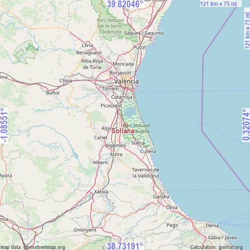
Sollana GPS coordinates[2]
39° 16' 41.88" North, 0° 22' 56.568" West
| Map corner | latitude | longitude |
|---|---|---|
| Upper-left | 39.82046°, | -1.08551° |
| Center: | 39.2783°, | -0.38238° |
| Lower-right: | 38.73191°, | 0.32074° |
| Map W x H: | 121×121 km | = 75.2×75.2mi |
| max Lat: | 43.74134° ⇑78.8% North |
| Sollana: | 39.2783° |
| min Lat: | ⇓21.2% South 27.64134° |
| min Long | Sollana | max Long |
| -18.00367° | -0.38238° | 4.2899° |
| W 83.4%⇐ | ⇒16.6% E |
Elevation
Elevation of Sollana is 7 m = 23 ft, and this is 591 m = 1939 ft below average elevation for this country.
| Max E: |
1682 m = 5518 ft | 99.2% |
| Avg. | 598 m = 1962 ft | |
| Sollana | 7 m = 23 ft | |
Min E: |
0 m = 0 ft | 0.8% |
See also: Spain elevation on elevation.city.
Geographical zone
Sollana is located in North temperate zone (between Tropic of Cancer and the Arctic Circle). Distance of this Northern Tropic circle is 1761.4 km =1094.5 mi to South.| Distance of | km | miles | from Sollana |
|---|---|---|---|
| North Pole | 5639.7 | 3504.3 | to North |
| Arctic Circle | 3033.8 | 1885.1 | to North |
| Tropic Cancer | 1761.4 | 1094.5 | to South |
| Equator | 4367.3 | 2713.7 | to South |


Nearby cities:
15 places around Sollana: (largest is in red/bold)
• Albalat de la Ribera
8.7 km =5.4 mi,  180°
180°
• Alcàsser
11.3 km =7 mi,  331°
331°
• Algemesí
10.8 km =6.7 mi,  205°
205°
• Alginet
7.4 km =4.6 mi,  259°
259°
• Almussafes
3 km =1.9 mi,  280°
280°
• Benicull de Xúquer
10.6 km =6.6 mi, 180°
• Benifaió
3.8 km =2.4 mi, 280°
• Beniparrell
12 km =7.5 mi,  345°
345°
• El Perelló
9.2 km =5.7 mi,  90°
90°
• Fortaleny
12.7 km =7.9 mi,  146°
146°
• Picassent
11.6 km =7.2 mi, 325°
• Polinyà de Xúquer
8.8 km =5.5 mi,  171°
171°
• Riola
9.7 km =6 mi, 154°
• Silla
9.7 km =6 mi,  344°
344°
• Sueca
10.4 km =6.5 mi,  143°
143°
Sources, notices
• [Note1] Compared only with cities in Spain existing in our database
• [Src1] Map data: © OpenStreetMap contributors (CC-BY-SA)
• [Src2] Other city data from geonames.org with taken over terms of usage.
• [Src3] Geographical zone / Annual Mean Temperature by Robert A. Rohde @ Wikipedia
