Selva geodata
Selva (Balearic Islands) is a seat of a third-order administrative division; located in Spain in Europe/Madrid (GMT+2) time zone. With population of 3,205 people, there are 1660 cities with bigger population in this country. Compared to other cities in Spain, 73.5% of cities are located further ↑North; 98.1% of cities are located further ←West and 81.3% of cities have higher elevation than Selva. Note1


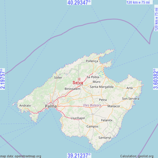
Selva GPS coordinates[2]
39° 45' 18.144" North, 2° 54' 2.484" East
| Map corner | latitude | longitude |
|---|---|---|
| Upper-left | 40.29347°, | 2.19757° |
| Center: | 39.75504°, | 2.90069° |
| Lower-right: | 39.21237°, | 3.60382° |
| Map W x H: | 120.2×120.2 km | = 74.7×74.7mi |
| max Lat: | 43.74134° ⇑73.5% North |
| Selva: | 39.75504° |
| min Lat: | ⇓26.5% South 27.64134° |
| min Long | Selva | max Long |
| -18.00367° | 2.90069° | 4.2899° |
| W 98.1%⇐ | ⇒1.9% E |
Elevation
Elevation of Selva is 198 m = 650 ft, and this is 400 m = 1312 ft below average elevation for this country.
| Max E: |
1682 m = 5518 ft | 81.3% |
| Avg. | 598 m = 1962 ft | |
| Selva | 198 m = 650 ft | |
Min E: |
0 m = 0 ft | 18.7% |
See also: Spain elevation on elevation.city.
Geographical zone
Selva is located in North temperate zone (between Tropic of Cancer and the Arctic Circle). Distance of this Northern Tropic circle is 1814.4 km =1127.4 mi to South.| Distance of | km | miles | from Selva |
|---|---|---|---|
| North Pole | 5586.7 | 3471.4 | to North |
| Arctic Circle | 2980.8 | 1852.2 | to North |
| Tropic Cancer | 1814.4 | 1127.4 | to South |
| Equator | 4420.3 | 2746.6 | to South |


Nearby cities:
15 places around Selva: (largest is in red/bold)
• Alaró
10.9 km =6.8 mi,  238°
238°
• Binissalem
8.9 km =5.5 mi,  212°
212°
• Búger
7.1 km =4.4 mi,  87°
87°
• Campanet
5.9 km =3.7 mi,  68°
68°
• Consell
12.2 km =7.6 mi,  218°
218°
• Costitx
11.7 km =7.3 mi,  159°
159°
• Escorca
7.8 km =4.8 mi,  340°
340°
• Fornalutx
14 km =8.7 mi,  282°
282°
• Inca
3.9 km =2.4 mi,  166°
166°
• Lloseta
5 km =3.1 mi, 215°
• Llubí
11 km =6.8 mi,  124°
124°
• Mancor de la Vall
2.5 km =1.6 mi,  255°
255°
• Muro
13.4 km =8.3 mi,  98°
98°
• Sencelles
12.1 km =7.5 mi,  181°
181°
• sa Pobla
10.7 km =6.6 mi,  81°
81°
Sources, notices
• [Note1] Compared only with cities in Spain existing in our database
• [Src1] Map data: © OpenStreetMap contributors (CC-BY-SA)
• [Src2] Other city data from geonames.org with taken over terms of usage.
• [Src3] Geographical zone / Annual Mean Temperature by Robert A. Rohde @ Wikipedia
