Infantes geodata
Infantes (Castille-La Mancha) is a populated place; located in Spain in Europe/Madrid (GMT+2) time zone. With population of 5,835 people, there are 1156 cities with bigger population in this country. Compared to other cities in Spain, 83.8% of cities are located further ↑North; 54.2% of cities are located further ←West and 78.5% of cities have lower elevation than Infantes. Note1
Administrative division(s):
- Level 1: Castille-La Mancha
- Level 2: Provincia de Ciudad Real
- Level 3: Torre de Juan Abad


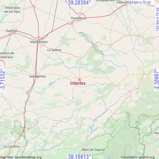
Infantes GPS coordinates[2]
38° 44' 12.084" North, 3° 0' 43.884" West
| Map corner | latitude | longitude |
|---|---|---|
| Upper-left | 39.28304°, | -3.71532° |
| Center: | 38.73669°, | -3.01219° |
| Lower-right: | 38.18613°, | -2.30907° |
| Map W x H: | 122×122 km | = 75.8×75.8mi |
| max Lat: | 43.74134° ⇑83.8% North |
| Infantes: | 38.73669° |
| min Lat: | ⇓16.2% South 27.64134° |
| min Long | Infantes | max Long |
| -18.00367° | -3.01219° | 4.2899° |
| W 54.2%⇐ | ⇒45.8% E |
Elevation
Elevation of Infantes is 885 m = 2904 ft, and this is 287 m = 942 ft above average elevation for this country.
| Max E: |
1682 m = 5518 ft | 21.5% |
| Infantes | 885 m 2904 ft | |
| Avg. | 598 m = 1962 ft | |
Min E: |
0 m = 0 ft | 78.5% |
See also: Spain elevation on elevation.city.
Geographical zone
Infantes is located in North temperate zone (between Tropic of Cancer and the Arctic Circle). Distance of this Northern Tropic circle is 1701.2 km =1057.1 mi to South.| Distance of | km | miles | from Infantes |
|---|---|---|---|
| North Pole | 5699.9 | 3541.8 | to North |
| Arctic Circle | 3094.1 | 1922.6 | to North |
| Tropic Cancer | 1701.2 | 1057.1 | to South |
| Equator | 4307.1 | 2676.3 | to South |


Nearby cities:
15 places around Infantes: (largest is in red/bold)
• Albaladejo
22.1 km =13.7 mi,  126°
126°
• Alcubillas
10.7 km =6.6 mi,  279°
279°
• Alhambra
18.4 km =11.4 mi,  348°
348°
• Almedina
13.5 km =8.4 mi,  157°
157°
• Carrizosa
11.8 km =7.3 mi,  8°
8°
• Cózar
9.8 km =6.1 mi,  212°
212°
• Fuenllana
5.2 km =3.2 mi,  65°
65°
• Montiel
13.5 km =8.4 mi,  108°
108°
• Puebla del Príncipe
20.2 km =12.6 mi, 158°
• San Carlos del Valle
23.2 km =14.4 mi,  300°
300°
• Santa Cruz de los Cáñamos
16.8 km =10.4 mi, 131°
• Terrinches
20.4 km =12.7 mi, 133°
• Torre de Juan Abad
17.5 km =10.9 mi,  193°
193°
• Villahermosa
12.4 km =7.7 mi,  83°
83°
• Villamanrique
21.2 km =13.2 mi,  176°
176°
Sources, notices
• [Note1] Compared only with cities in Spain existing in our database
• [Src1] Map data: © OpenStreetMap contributors (CC-BY-SA)
• [Src2] Other city data from geonames.org with taken over terms of usage.
• [Src3] Geographical zone / Annual Mean Temperature by Robert A. Rohde @ Wikipedia
