Porzuna geodata
Porzuna (Castille-La Mancha) is a seat of a third-order administrative division; located in Spain in Europe/Madrid (GMT+2) time zone. With population of 3,978 people, there are 1483 cities with bigger population in this country. Compared to other cities in Spain, 79.9% of cities are located further ↑North; 62% of cities are located further →East and 50.9% of cities have higher elevation than Porzuna. Note1
Administrative division(s):
- Level 1: Castille-La Mancha
- Level 2: Provincia de Ciudad Real
- Level 3: Porzuna


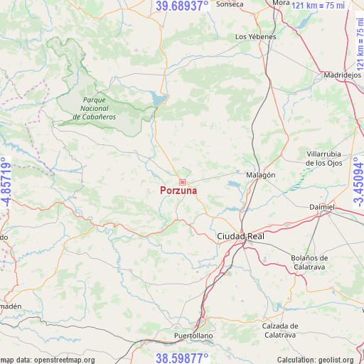
Porzuna GPS coordinates[2]
39° 8' 46.248" North, 4° 9' 14.652" West
| Map corner | latitude | longitude |
|---|---|---|
| Upper-left | 39.68937°, | -4.85719° |
| Center: | 39.14618°, | -4.15407° |
| Lower-right: | 38.59877°, | -3.45094° |
| Map W x H: | 121.3×121.3 km | = 75.4×75.4mi |
| max Lat: | 43.74134° ⇑79.9% North |
| Porzuna: | 39.14618° |
| min Lat: | ⇓20.1% South 27.64134° |
| min Long | Porzuna | max Long |
| -18.00367° | -4.15407° | 4.2899° |
| W 38%⇐ | ⇒62% E |
Elevation
Elevation of Porzuna is 649 m = 2129 ft, and this is 51 m = 167 ft above average elevation for this country.
| Max E: |
1682 m = 5518 ft | 50.9% |
| Porzuna | 649 m 2129 ft | |
| Avg. | 598 m = 1962 ft | |
Min E: |
0 m = 0 ft | 49.1% |
See also: Spain elevation on elevation.city.
Geographical zone
Porzuna is located in North temperate zone (between Tropic of Cancer and the Arctic Circle). Distance of this Northern Tropic circle is 1746.7 km =1085.3 mi to South.| Distance of | km | miles | from Porzuna |
|---|---|---|---|
| North Pole | 5654.4 | 3513.5 | to North |
| Arctic Circle | 3048.5 | 1894.2 | to North |
| Tropic Cancer | 1746.7 | 1085.3 | to South |
| Equator | 4352.6 | 2704.6 | to South |


Nearby cities:
15 places around Porzuna: (largest is in red/bold)
• Alcoba
30.6 km =19 mi,  294°
294°
• Alcolea de Calatrava
18 km =11.2 mi,  169°
169°
• Arroba
33.6 km =20.9 mi,  271°
271°
• Ballesteros
21.7 km =13.5 mi,  48°
48°
• Carrión de Calatrava
32.4 km =20.1 mi,  115°
115°
• Ciudad Real
26.3 km =16.3 mi,  132°
132°
• Corral de Calatrava
32.7 km =20.3 mi, 168°
• El Robledo
13.6 km =8.5 mi,  306°
306°
• Fontanarejo
32.4 km =20.1 mi,  284°
284°
• Fuencaliente
11.9 km =7.4 mi,  68°
68°
• Malagón
26 km =16.2 mi,  84°
84°
• Miguelturra
30.4 km =18.9 mi, 131°
• Picón
13.3 km =8.3 mi,  142°
142°
• Piedrabuena
12.5 km =7.8 mi,  188°
188°
• Poblete
27.8 km =17.3 mi,  147°
147°
Sources, notices
• [Note1] Compared only with cities in Spain existing in our database
• [Src1] Map data: © OpenStreetMap contributors (CC-BY-SA)
• [Src2] Other city data from geonames.org with taken over terms of usage.
• [Src3] Geographical zone / Annual Mean Temperature by Robert A. Rohde @ Wikipedia
