Ballesteros geodata
Ballesteros (Castille-La Mancha) is a populated place; located in Spain in Europe/Madrid (GMT+2) time zone. With population of 652 people, there are 3498 cities with bigger population in this country. Compared to other cities in Spain, 78.8% of cities are located further ↑North; 59.2% of cities are located further →East and 55.4% of cities have lower elevation than Ballesteros. Note1
Administrative division(s):
- Level 1: Castille-La Mancha
- Level 2: Provincia de Ciudad Real
- Level 3: Malagón


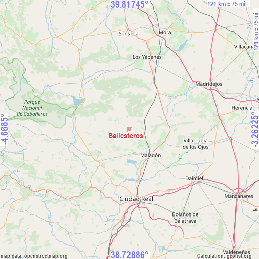
Ballesteros GPS coordinates[2]
39° 16' 30.972" North, 3° 57' 55.332" West
| Map corner | latitude | longitude |
|---|---|---|
| Upper-left | 39.81745°, | -4.6685° |
| Center: | 39.27527°, | -3.96537° |
| Lower-right: | 38.72886°, | -3.26225° |
| Map W x H: | 121×121 km | = 75.2×75.2mi |
| max Lat: | 43.74134° ⇑78.8% North |
| Ballesteros: | 39.27527° |
| min Lat: | ⇓21.2% South 27.64134° |
| min Long | Ballesteros | max Long |
| -18.00367° | -3.96537° | 4.2899° |
| W 40.8%⇐ | ⇒59.2% E |
Elevation
Elevation of Ballesteros is 712 m = 2336 ft, and this is 114 m = 374 ft above average elevation for this country.
| Max E: |
1682 m = 5518 ft | 44.6% |
| Ballesteros | 712 m 2336 ft | |
| Avg. | 598 m = 1962 ft | |
Min E: |
0 m = 0 ft | 55.4% |
See also: Spain elevation on elevation.city.
Geographical zone
Ballesteros is located in North temperate zone (between Tropic of Cancer and the Arctic Circle). Distance of this Northern Tropic circle is 1761.1 km =1094.3 mi to South.| Distance of | km | miles | from Ballesteros |
|---|---|---|---|
| North Pole | 5640.1 | 3504.6 | to North |
| Arctic Circle | 3034.2 | 1885.4 | to North |
| Tropic Cancer | 1761.1 | 1094.3 | to South |
| Equator | 4367 | 2713.5 | to South |


Nearby cities:
15 places around Ballesteros: (largest is in red/bold)
• Alcolea de Calatrava
34.6 km =21.5 mi,  202°
202°
• Carrión de Calatrava
31.2 km =19.4 mi,  155°
155°
• Ciudad Real
32.3 km =20.1 mi,  174°
174°
• El Robledo
27.9 km =17.3 mi,  257°
257°
• Fuencaliente
11.2 km =7 mi,  207°
207°
• Fuente el Fresno
17.2 km =10.7 mi,  107°
107°
• Los Yébenes
35 km =21.7 mi,  13°
13°
• Malagón
15.4 km =9.6 mi,  141°
141°
• Marjaliza
32.1 km =19.9 mi,  4°
4°
• Picón
26.3 km =16.3 mi, 198°
• Piedrabuena
32.2 km =20 mi, 214°
• Porzuna
21.7 km =13.5 mi,  228°
228°
• Torralba de Calatrava
34.1 km =21.2 mi,  147°
147°
• Urda
26.3 km =16.3 mi,  54°
54°
• Villarrubia de los Ojos
31.4 km =19.5 mi,  101°
101°
Sources, notices
• [Note1] Compared only with cities in Spain existing in our database
• [Src1] Map data: © OpenStreetMap contributors (CC-BY-SA)
• [Src2] Other city data from geonames.org with taken over terms of usage.
• [Src3] Geographical zone / Annual Mean Temperature by Robert A. Rohde @ Wikipedia
