La Puebla de los Infantes geodata
La Puebla de los Infantes (Andalusia) is a populated place; located in Spain in Europe/Madrid (GMT+2) time zone. With population of 3,301 people, there are 1635 cities with bigger population in this country. Compared to other cities in Spain, 89.7% of cities are located further ↑North; 77.3% of cities are located further →East and 79.9% of cities have higher elevation than La Puebla de los Infantes. Note1
Administrative division(s):
- Level 1: Andalusia
- Level 2: Provincia de Sevilla
- Level 3: Puebla de los Infantes, La
Current local time in La Puebla de los Infantes:
09:37 PM, ThursdayDifference from your time zone: hours


La Puebla de los Infantes GPS coordinates[2]
37° 46' 51.24" North, 5° 23' 18.132" West
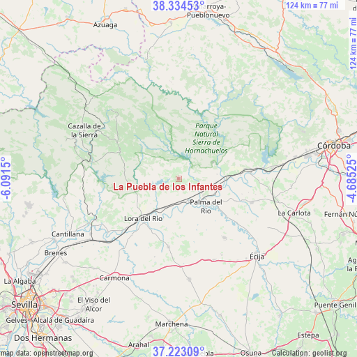
| Map corner | latitude | longitude |
|---|---|---|
| Upper-left | 38.33453°, | -6.0915° |
| Center: | 37.7809°, | -5.38837° |
| Lower-right: | 37.22309°, | -4.68525° |
| Map W x H: | 123.6×123.6 km | = 76.8×76.8mi |
| max Lat: | 43.74134° ⇑89.7% North |
| La Puebla de los Infantes: | 37.7809° |
| min Lat: | ⇓10.3% South 27.64134° |
| min Long | La Puebla de lo | max Long |
| -18.00367° | -5.38837° | 4.2899° |
| W 22.7%⇐ | ⇒77.3% E |
Elevation
Elevation of La Puebla de los Infantes is 222 m = 728 ft, and this is 376 m = 1234 ft below average elevation for this country.
| Max E: |
1682 m = 5518 ft | 79.9% |
| Avg. | 598 m = 1962 ft | |
| La Puebla de los Infantes | 222 m = 728 ft | |
Min E: |
0 m = 0 ft | 20.1% |
See also: Spain elevation on elevation.city.
Geographical zone
La Puebla de los Infantes is located in North temperate zone (between Tropic of Cancer and the Arctic Circle). Distance of this Northern Tropic circle is 1594.9 km =991 mi to South.| Distance of | km | miles | from La Puebla de los Infantes |
|---|---|---|---|
| North Pole | 5806.2 | 3607.8 | to North |
| Arctic Circle | 3200.3 | 1988.6 | to North |
| Tropic Cancer | 1594.9 | 991 | to South |
| Equator | 4200.8 | 2610.3 | to South |


Nearby cities:
15 places around La Puebla de los Infantes: (largest is in red/bold)
• Alcolea del Río
30.7 km =19.1 mi,  233°
233°
• Almodóvar del Río
32.5 km =20.2 mi,  84°
84°
• Cañada Rosal
25.6 km =15.9 mi,  142°
142°
• Constantina
22.2 km =13.8 mi,  295°
295°
• Fuente Palmera
26.8 km =16.7 mi,  108°
108°
• Fuentes de Andalucía
35.4 km =22 mi,  173°
173°
• Hornachuelos
14.8 km =9.2 mi,  66°
66°
• La Campana
23.8 km =14.8 mi,  188°
188°
• La Luisiana
30.9 km =19.2 mi,  156°
156°
• Lora del Río
18.3 km =11.4 mi,  222°
222°
• Palma del Río
13 km =8.1 mi,  133°
133°
• Peñaflor
8.9 km =5.5 mi,  154°
154°
• Posadas
24.8 km =15.4 mi, 84°
• San Nicolás del Puerto
33.5 km =20.8 mi,  316°
316°
• Villanueva del Río y Minas
31.9 km =19.8 mi,  243°
243°
Sources, notices
• [Note1] Compared only with cities in Spain existing in our database
• [Src1] Map data: © OpenStreetMap contributors (CC-BY-SA)
• [Src2] Other city data from geonames.org with taken over terms of usage.
• [Src3] Geographical zone / Annual Mean Temperature by Robert A. Rohde @ Wikipedia
