Frontera geodata
Frontera (Canary Islands) is a seat of a third-order administrative division; located in Spain in Atlantic/Canary (GMT+1) time zone. With population of 4,010 people, there are 1471 cities with bigger population in this country. Compared to other cities in Spain, 100% of cities are located further ↑North; 100% of cities are located further →East and 72.2% of cities have higher elevation than Frontera. Note1
Administrative division(s):
- Level 1: Canary Islands
- Level 2: Provincia de Santa Cruz de Tenerife
- Level 3: Frontera


Frontera GPS coordinates[2]
27° 45' 14.544" North, 18° 0' 13.212" West
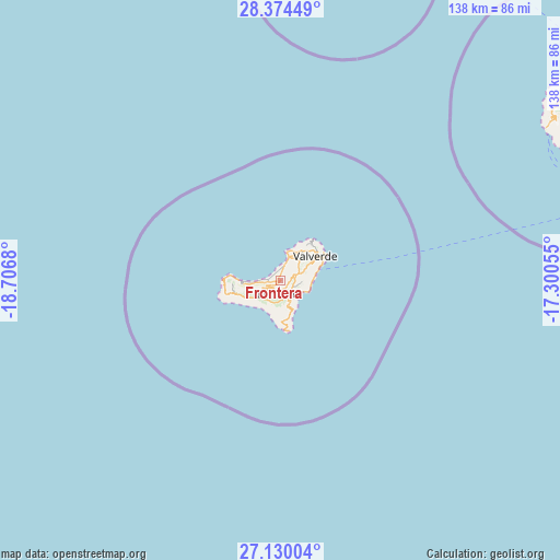
| Map corner | latitude | longitude |
|---|---|---|
| Upper-left | 28.37449°, | -18.7068° |
| Center: | 27.75404°, | -18.00367° |
| Lower-right: | 27.13004°, | -17.30055° |
| Map W x H: | 138.4×138.4 km | = 86×86mi |
| max Lat: | 43.74134° ⇑100% North |
| Frontera: | 27.75404° |
| min Lat: | ⇓0% South 27.64134° |
| min Long | Frontera | max Long |
| -18.00367° | -18.00367° | 4.2899° |
| W 0%⇐ | ⇒100% E |
Elevation
Elevation of Frontera is 342 m = 1122 ft, and this is 256 m = 840 ft below average elevation for this country.
| Max E: |
1682 m = 5518 ft | 72.2% |
| Avg. | 598 m = 1962 ft | |
| Frontera | 342 m = 1122 ft | |
Min E: |
0 m = 0 ft | 27.8% |
See also: Spain elevation on elevation.city.
Geographical zone
Frontera is located in North temperate zone (between Tropic of Cancer and the Arctic Circle). Distance of this Northern Tropic circle is 480 km =298.3 mi to South.| Distance of | km | miles | from Frontera |
|---|---|---|---|
| North Pole | 6921.1 | 4300.6 | to North |
| Arctic Circle | 4315.2 | 2681.3 | to North |
| Tropic Cancer | 480 | 298.3 | to South |
| Equator | 3086 | 1917.6 | to South |


Nearby cities:
15 places around Frontera: (largest is in red/bold)
• Agulo
92.8 km =57.7 mi,  58°
58°
• Alajeró
82.4 km =51.2 mi,  65°
65°
• Breña Baja
99.6 km =61.9 mi,  12°
12°
• El Paso
100.3 km =62.3 mi, 6°
• Fuencaliente de la Palma
83.5 km =51.9 mi, 10°
• Hermigua
92.2 km =57.3 mi, 60°
• La Restinga
12.7 km =7.9 mi,  170°
170°
• Los Llanos de Aridane
100.9 km =62.7 mi,  4°
4°
• Mazo
97.6 km =60.6 mi, 13°
• Playa de Santiago
84.9 km =52.8 mi, 68°
• Puerto Naos
93 km =57.8 mi, 5°
• San Sebastián de la Gomera
95.2 km =59.2 mi, 66°
• Tazacorte
99 km =61.5 mi, 3°
• Vallehermosa
86.5 km =53.7 mi, 56°
• Valverde
10.4 km =6.5 mi, 56°
Sources, notices
• [Note1] Compared only with cities in Spain existing in our database
• [Src1] Map data: © OpenStreetMap contributors (CC-BY-SA)
• [Src2] Other city data from geonames.org with taken over terms of usage.
• [Src3] Geographical zone / Annual Mean Temperature by Robert A. Rohde @ Wikipedia
