San Sebastián de la Gomera geodata
San Sebastián de la Gomera (Canary Islands) is a populated place; located in Spain in Atlantic/Canary (GMT+1) time zone. With population of 8,964 people, there are 893 cities with bigger population in this country. Compared to other cities in Spain, 99.6% of cities are located further ↑North; 99.7% of cities are located further →East and 98.9% of cities have higher elevation than San Sebastián de la Gomera. Note1
Administrative division(s):
- Level 1: Canary Islands
- Level 2: Provincia de Santa Cruz de Tenerife
- Level 3: San Sebastián de la Gomera
Current local time in San Sebastián de la Gomera:
08:14 PM, ThursdayDifference from your time zone: hours


San Sebastián de la Gomera GPS coordinates[2]
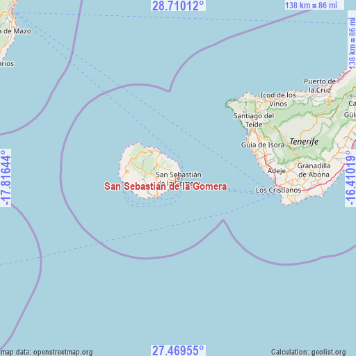
28° 5' 29.868" North, 17° 6' 47.916" West
| Map corner | latitude | longitude |
|---|---|---|
| Upper-left | 28.71012°, | -17.81644° |
| Center: | 28.09163°, | -17.11331° |
| Lower-right: | 27.46955°, | -16.41019° |
| Map W x H: | 137.9×137.9 km | = 85.7×85.7mi |
| max Lat: | 43.74134° ⇑99.6% North |
| San Sebastián de la Gomera: | 28.09163° |
| min Lat: | ⇓0.4% South 27.64134° |
| min Long | San Sebastián | max Long |
| -18.00367° | -17.11331° | 4.2899° |
| W 0.3%⇐ | ⇒99.7% E |
Elevation
Elevation of San Sebastián de la Gomera is 8 m = 26 ft, and this is 590 m = 1936 ft below average elevation for this country.
| Max E: |
1682 m = 5518 ft | 98.9% |
| Avg. | 598 m = 1962 ft | |
| San Sebastián de la Gomera | 8 m = 26 ft | |
Min E: |
0 m = 0 ft | 1.1% |
See also: Spain elevation on elevation.city.
Geographical zone
San Sebastián de la Gomera is located in North temperate zone (between Tropic of Cancer and the Arctic Circle). Distance of this Northern Tropic circle is 517.6 km =321.6 mi to South.| Distance of | km | miles | from San Sebastián de la Gomera |
|---|---|---|---|
| North Pole | 6883.6 | 4277.3 | to North |
| Arctic Circle | 4277.7 | 2658 | to North |
| Tropic Cancer | 517.6 | 321.6 | to South |
| Equator | 3123.5 | 1940.9 | to South |


Nearby cities:
15 places around San Sebastián de la Gomera: (largest is in red/bold)
• Adeje
38.1 km =23.7 mi,  84°
84°
• Agulo
13.5 km =8.4 mi,  322°
322°
• Alajeró
12.9 km =8 mi,  255°
255°
• Arona
42.4 km =26.3 mi,  88°
88°
• Buenavista del Norte
40 km =24.9 mi,  38°
38°
• Guía de Isora
35.3 km =21.9 mi,  67°
67°
• Hermigua
11.3 km =7 mi, 318°
• Los Gigantes
31.5 km =19.6 mi,  57°
57°
• Los Silos
42.2 km =26.2 mi, 43°
• Playa de Santiago
10.8 km =6.7 mi,  230°
230°
• Playa de las Américas
37.7 km =23.4 mi, 94°
• Puerto de Santiago
31 km =19.3 mi, 58°
• Santiago del Teide
36.8 km =22.9 mi,  52°
52°
• Tanque
41.1 km =25.5 mi, 41°
• Vallehermosa
17.9 km =11.1 mi,  303°
303°
Sources, notices
• [Note1] Compared only with cities in Spain existing in our database
• [Src1] Map data: © OpenStreetMap contributors (CC-BY-SA)
• [Src2] Other city data from geonames.org with taken over terms of usage.
• [Src3] Geographical zone / Annual Mean Temperature by Robert A. Rohde @ Wikipedia
