Chinchilla de Monte Aragón geodata
Chinchilla de Monte Aragón (Castille-La Mancha) is a populated place; located in Spain in Europe/Madrid (GMT+2) time zone. With population of 3,355 people, there are 1620 cities with bigger population in this country. Compared to other cities in Spain, 81.9% of cities are located further ↑North; 70.4% of cities are located further ←West and 79% of cities have lower elevation than Chinchilla de Monte Aragón. Note1
Administrative division(s):
- Level 1: Castille-La Mancha
- Level 2: Provincia de Albacete
- Level 3: Chinchilla de Monte-Aragón
Current local time in Chinchilla de Monte Aragón:
10:51 PM, ThursdayDifference from your time zone: hours


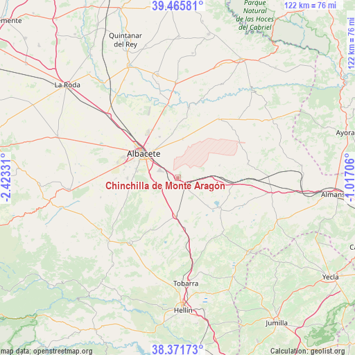
Chinchilla de Monte Aragón GPS coordinates[2]
38° 55' 15.168" North, 1° 43' 12.648" West
| Map corner | latitude | longitude |
|---|---|---|
| Upper-left | 39.46581°, | -2.42331° |
| Center: | 38.92088°, | -1.72018° |
| Lower-right: | 38.37173°, | -1.01706° |
| Map W x H: | 121.7×121.6 km | = 75.6×75.6mi |
| max Lat: | 43.74134° ⇑81.9% North |
| Chinchilla de Monte Aragón: | 38.92088° |
| min Lat: | ⇓18.1% South 27.64134° |
| min Long | Chinchilla de M | max Long |
| -18.00367° | -1.72018° | 4.2899° |
| W 70.4%⇐ | ⇒29.6% E |
Elevation
Elevation of Chinchilla de Monte Aragón is 889 m = 2917 ft, and this is 291 m = 955 ft above average elevation for this country.
| Max E: |
1682 m = 5518 ft | 21% |
| Chinchilla de Monte Aragón | 889 m 2917 ft | |
| Avg. | 598 m = 1962 ft | |
Min E: |
0 m = 0 ft | 79% |
See also: Spain elevation on elevation.city.
Geographical zone
Chinchilla de Monte Aragón is located in North temperate zone (between Tropic of Cancer and the Arctic Circle). Distance of this Northern Tropic circle is 1721.7 km =1069.8 mi to South.| Distance of | km | miles | from Chinchilla de Monte Aragón |
|---|---|---|---|
| North Pole | 5679.5 | 3529.1 | to North |
| Arctic Circle | 3073.6 | 1909.8 | to North |
| Tropic Cancer | 1721.7 | 1069.8 | to South |
| Equator | 4327.6 | 2689 | to South |


Nearby cities:
15 places around Chinchilla de Monte Aragón: (largest is in red/bold)
• Albacete
14.3 km =8.9 mi,  304°
304°
• Bonete
32.6 km =20.3 mi,  99°
99°
• Casas de Juan Núñez
24.5 km =15.2 mi,  34°
34°
• Corral-Rubio
24.5 km =15.2 mi,  113°
113°
• Higueruela
24.4 km =15.2 mi,  78°
78°
• Hoya-Gonzalo
14.7 km =9.1 mi,  73°
73°
• Jorquera
32.5 km =20.2 mi, 32°
• La Gineta
32.1 km =19.9 mi,  312°
312°
• Motilleja
29.7 km =18.5 mi,  349°
349°
• Pozo Lorente
25.3 km =15.7 mi,  46°
46°
• Pozo-Cañada
13.1 km =8.1 mi,  185°
185°
• Pozohondo
27.8 km =17.3 mi,  216°
216°
• Pétrola
17.6 km =10.9 mi,  126°
126°
• Valdeganga
24.1 km =15 mi,  8°
8°
• Villavaliente
32.2 km =20 mi,  44°
44°
Sources, notices
• [Note1] Compared only with cities in Spain existing in our database
• [Src1] Map data: © OpenStreetMap contributors (CC-BY-SA)
• [Src2] Other city data from geonames.org with taken over terms of usage.
• [Src3] Geographical zone / Annual Mean Temperature by Robert A. Rohde @ Wikipedia
