Corral-Rubio geodata
Corral-Rubio (Castille-La Mancha) is a seat of a third-order administrative division; located in Spain in Europe/Madrid (GMT+2) time zone. With population of 425 people, there are 4064 cities with bigger population in this country. Compared to other cities in Spain, 82.9% of cities are located further ↑North; 73.3% of cities are located further ←West and 77.6% of cities have lower elevation than Corral-Rubio. Note1
Administrative division(s):
- Level 1: Castille-La Mancha
- Level 2: Provincia de Albacete
- Level 3: Corral-Rubio


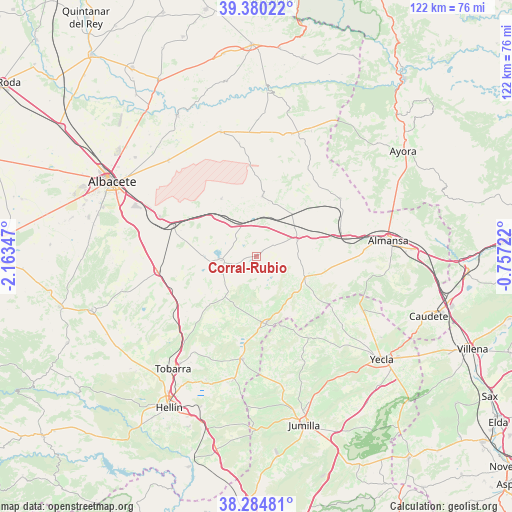
Corral-Rubio GPS coordinates[2]
38° 50' 4.632" North, 1° 27' 37.224" West
| Map corner | latitude | longitude |
|---|---|---|
| Upper-left | 39.38022°, | -2.16347° |
| Center: | 38.83462°, | -1.46034° |
| Lower-right: | 38.28481°, | -0.75722° |
| Map W x H: | 121.8×121.8 km | = 75.7×75.7mi |
| max Lat: | 43.74134° ⇑82.9% North |
| Corral-Rubio: | 38.83462° |
| min Lat: | ⇓17.1% South 27.64134° |
| min Long | Corral-Rubio | max Long |
| -18.00367° | -1.46034° | 4.2899° |
| W 73.3%⇐ | ⇒26.7% E |
Elevation
Elevation of Corral-Rubio is 875 m = 2871 ft, and this is 277 m = 909 ft above average elevation for this country.
| Max E: |
1682 m = 5518 ft | 22.4% |
| Corral-Rubio | 875 m 2871 ft | |
| Avg. | 598 m = 1962 ft | |
Min E: |
0 m = 0 ft | 77.6% |
See also: Spain elevation on elevation.city.
Geographical zone
Corral-Rubio is located in North temperate zone (between Tropic of Cancer and the Arctic Circle). Distance of this Northern Tropic circle is 1712.1 km =1063.8 mi to South.| Distance of | km | miles | from Corral-Rubio |
|---|---|---|---|
| North Pole | 5689.1 | 3535 | to North |
| Arctic Circle | 3083.2 | 1915.8 | to North |
| Tropic Cancer | 1712.1 | 1063.8 | to South |
| Equator | 4318 | 2683.1 | to South |


Nearby cities:
15 places around Corral-Rubio: (largest is in red/bold)
• Alatoz
30.2 km =18.8 mi,  16°
16°
• Albatana
29.8 km =18.5 mi,  190°
190°
• Almansa
31.7 km =19.7 mi,  83°
83°
• Alpera
24.2 km =15 mi,  55°
55°
• Bonete
10.5 km =6.5 mi,  67°
67°
• Casas de Juan Núñez
30.9 km =19.2 mi,  344°
344°
• Chinchilla de Monte Aragón
24.5 km =15.2 mi,  293°
293°
• Fuente-Álamo
16 km =9.9 mi,  171°
171°
• Higueruela
14.4 km =8.9 mi,  5°
5°
• Hoya-Gonzalo
16 km =9.9 mi,  328°
328°
• Montealegre del Castillo
12.6 km =7.8 mi,  113°
113°
• Ontur
24.6 km =15.3 mi, 187°
• Pozo Lorente
27.2 km =16.9 mi,  351°
351°
• Pozo-Cañada
24.1 km =15 mi,  261°
261°
• Pétrola
8.4 km =5.2 mi, 263°
Sources, notices
• [Note1] Compared only with cities in Spain existing in our database
• [Src1] Map data: © OpenStreetMap contributors (CC-BY-SA)
• [Src2] Other city data from geonames.org with taken over terms of usage.
• [Src3] Geographical zone / Annual Mean Temperature by Robert A. Rohde @ Wikipedia
