Pozohondo geodata
Pozohondo (Castille-La Mancha) is a seat of a third-order administrative division; located in Spain in Europe/Madrid (GMT+2) time zone. With population of 1,829 people, there are 2270 cities with bigger population in this country. Compared to other cities in Spain, 84% of cities are located further ↑North; 68.3% of cities are located further ←West and 77.1% of cities have lower elevation than Pozohondo. Note1
Administrative division(s):
- Level 1: Castille-La Mancha
- Level 2: Provincia de Albacete
- Level 3: Pozohondo


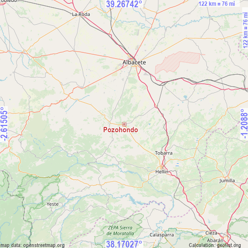
Pozohondo GPS coordinates[2]
38° 43' 15.42" North, 1° 54' 42.912" West
| Map corner | latitude | longitude |
|---|---|---|
| Upper-left | 39.26742°, | -2.61505° |
| Center: | 38.72095°, | -1.91192° |
| Lower-right: | 38.17027°, | -1.2088° |
| Map W x H: | 122×122 km | = 75.8×75.8mi |
| max Lat: | 43.74134° ⇑84% North |
| Pozohondo: | 38.72095° |
| min Lat: | ⇓16% South 27.64134° |
| min Long | Pozohondo | max Long |
| -18.00367° | -1.91192° | 4.2899° |
| W 68.3%⇐ | ⇒31.7% E |
Elevation
Elevation of Pozohondo is 871 m = 2858 ft, and this is 273 m = 896 ft above average elevation for this country.
| Max E: |
1682 m = 5518 ft | 22.9% |
| Pozohondo | 871 m 2858 ft | |
| Avg. | 598 m = 1962 ft | |
Min E: |
0 m = 0 ft | 77.1% |
See also: Spain elevation on elevation.city.
Geographical zone
Pozohondo is located in North temperate zone (between Tropic of Cancer and the Arctic Circle). Distance of this Northern Tropic circle is 1699.4 km =1056 mi to South.| Distance of | km | miles | from Pozohondo |
|---|---|---|---|
| North Pole | 5701.7 | 3542.9 | to North |
| Arctic Circle | 3095.8 | 1923.6 | to North |
| Tropic Cancer | 1699.4 | 1056 | to South |
| Equator | 4305.4 | 2675.3 | to South |


Nearby cities:
15 places around Pozohondo: (largest is in red/bold)
• Albacete
30.8 km =19.1 mi,  8°
8°
• Alcadozo
9.9 km =6.2 mi,  216°
216°
• Ayna
24.1 km =15 mi, 218°
• Balazote
27.6 km =17.1 mi,  311°
311°
• Bogarra
30.4 km =18.9 mi,  239°
239°
• Casas de Lázaro
29 km =18 mi,  280°
280°
• Chinchilla de Monte Aragón
27.8 km =17.3 mi,  36°
36°
• Elche de la Sierra
32.2 km =20 mi,  201°
201°
• Hellín
29.7 km =18.5 mi,  141°
141°
• Liétor
20.2 km =12.6 mi,  190°
190°
• Peñas de San Pedro
8.1 km =5 mi, 276°
• Pozo-Cañada
17.8 km =11.1 mi,  59°
59°
• Pozuelo
19.1 km =11.9 mi,  301°
301°
• San Pedro
26.2 km =16.3 mi, 296°
• Tobarra
23.9 km =14.9 mi,  126°
126°
Sources, notices
• [Note1] Compared only with cities in Spain existing in our database
• [Src1] Map data: © OpenStreetMap contributors (CC-BY-SA)
• [Src2] Other city data from geonames.org with taken over terms of usage.
• [Src3] Geographical zone / Annual Mean Temperature by Robert A. Rohde @ Wikipedia
