Hoya-Gonzalo geodata
Hoya-Gonzalo (Castille-La Mancha) is a seat of a third-order administrative division; located in Spain in Europe/Madrid (GMT+2) time zone. With population of 938 people, there are 3030 cities with bigger population in this country. Compared to other cities in Spain, 81.4% of cities are located further ↑North; 72.4% of cities are located further ←West and 83.6% of cities have lower elevation than Hoya-Gonzalo. Note1
Administrative division(s):
- Level 1: Castille-La Mancha
- Level 2: Provincia de Albacete
- Level 3: Hoya-Gonzalo


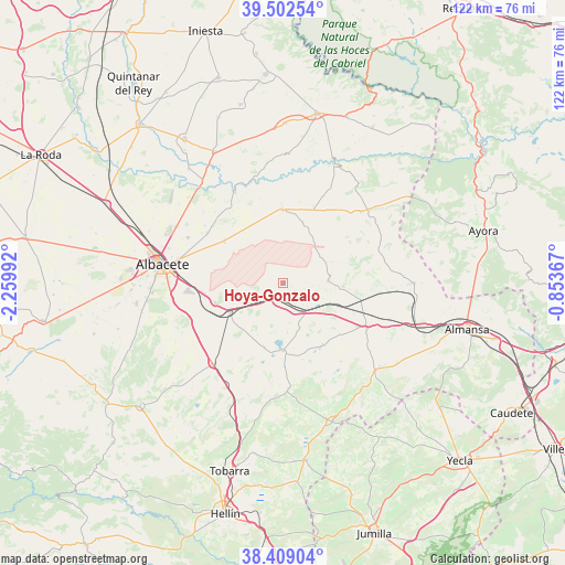
Hoya-Gonzalo GPS coordinates[2]
38° 57' 28.44" North, 1° 33' 24.444" West
| Map corner | latitude | longitude |
|---|---|---|
| Upper-left | 39.50254°, | -2.25992° |
| Center: | 38.9579°, | -1.55679° |
| Lower-right: | 38.40904°, | -0.85367° |
| Map W x H: | 121.6×121.6 km | = 75.6×75.6mi |
| max Lat: | 43.74134° ⇑81.4% North |
| Hoya-Gonzalo: | 38.9579° |
| min Lat: | ⇓18.6% South 27.64134° |
| min Long | Hoya-Gonzalo | max Long |
| -18.00367° | -1.55679° | 4.2899° |
| W 72.4%⇐ | ⇒27.6% E |
Elevation
Elevation of Hoya-Gonzalo is 935 m = 3068 ft, and this is 337 m = 1106 ft above average elevation for this country.
| Max E: |
1682 m = 5518 ft | 16.4% |
| Hoya-Gonzalo | 935 m 3068 ft | |
| Avg. | 598 m = 1962 ft | |
Min E: |
0 m = 0 ft | 83.6% |
See also: Spain elevation on elevation.city.
Geographical zone
Hoya-Gonzalo is located in North temperate zone (between Tropic of Cancer and the Arctic Circle). Distance of this Northern Tropic circle is 1725.8 km =1072.4 mi to South.| Distance of | km | miles | from Hoya-Gonzalo |
|---|---|---|---|
| North Pole | 5675.3 | 3526.5 | to North |
| Arctic Circle | 3069.5 | 1907.3 | to North |
| Tropic Cancer | 1725.8 | 1072.4 | to South |
| Equator | 4331.7 | 2691.6 | to South |


Nearby cities:
15 places around Hoya-Gonzalo: (largest is in red/bold)
• Alatoz
22.8 km =14.2 mi,  47°
47°
• Albacete
26.2 km =16.3 mi,  278°
278°
• Bonete
20.4 km =12.7 mi,  118°
118°
• Carcelén
26.8 km =16.7 mi, 53°
• Casas de Juan Núñez
16 km =9.9 mi,  359°
359°
• Chinchilla de Monte Aragón
14.7 km =9.1 mi,  253°
253°
• Corral-Rubio
16 km =9.9 mi,  148°
148°
• Higueruela
9.8 km =6.1 mi,  86°
86°
• Jorquera
23.5 km =14.6 mi,  8°
8°
• Montealegre del Castillo
27.4 km =17 mi,  133°
133°
• Pozo Lorente
13.9 km =8.6 mi,  18°
18°
• Pozo-Cañada
23.1 km =14.4 mi,  221°
221°
• Pétrola
14.6 km =9.1 mi,  179°
179°
• Valdeganga
22.3 km =13.9 mi,  332°
332°
• Villavaliente
20.6 km =12.8 mi, 24°
Sources, notices
• [Note1] Compared only with cities in Spain existing in our database
• [Src1] Map data: © OpenStreetMap contributors (CC-BY-SA)
• [Src2] Other city data from geonames.org with taken over terms of usage.
• [Src3] Geographical zone / Annual Mean Temperature by Robert A. Rohde @ Wikipedia
