Casas de Millán geodata
Casas de Millán (Extremadura) is a seat of a third-order administrative division; located in Spain in Europe/Madrid (GMT+2) time zone. With population of 709 people, there are 3390 cities with bigger population in this country. Compared to other cities in Spain, 72.7% of cities are located further ↑North; 89.7% of cities are located further →East and 64.1% of cities have higher elevation than Casas de Millán. Note1
Administrative division(s):
- Level 1: Extremadura
- Level 2: Provincia de Cáceres
- Level 3: Casas de Millán


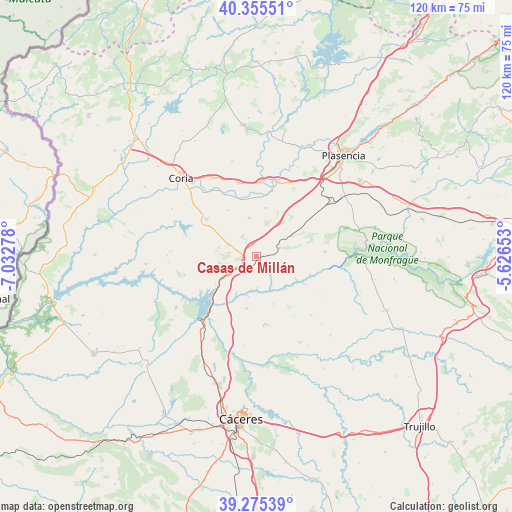
Casas de Millán GPS coordinates[2]
39° 49' 3.252" North, 6° 19' 46.776" West
| Map corner | latitude | longitude |
|---|---|---|
| Upper-left | 40.35551°, | -7.03278° |
| Center: | 39.81757°, | -6.32966° |
| Lower-right: | 39.27539°, | -5.62653° |
| Map W x H: | 120.1×120.1 km | = 74.6×74.6mi |
| max Lat: | 43.74134° ⇑72.7% North |
| Casas de Millán: | 39.81757° |
| min Lat: | ⇓27.3% South 27.64134° |
| min Long | Casas de Millá | max Long |
| -18.00367° | -6.32966° | 4.2899° |
| W 10.3%⇐ | ⇒89.7% E |
Elevation
Elevation of Casas de Millán is 471 m = 1545 ft, and this is 127 m = 417 ft below average elevation for this country.
| Max E: |
1682 m = 5518 ft | 64.1% |
| Avg. | 598 m = 1962 ft | |
| Casas de Millán | 471 m = 1545 ft | |
Min E: |
0 m = 0 ft | 35.9% |
See also: Spain elevation on elevation.city.
Geographical zone
Casas de Millán is located in North temperate zone (between Tropic of Cancer and the Arctic Circle). Distance of this Northern Tropic circle is 1821.4 km =1131.8 mi to South.| Distance of | km | miles | from Casas de Millán |
|---|---|---|---|
| North Pole | 5579.8 | 3467.1 | to North |
| Arctic Circle | 2973.9 | 1847.9 | to North |
| Tropic Cancer | 1821.4 | 1131.8 | to South |
| Equator | 4427.3 | 2751 | to South |


Nearby cities:
15 places around Casas de Millán: (largest is in red/bold)
• Cañaveral
6 km =3.7 mi,  241°
241°
• Galisteo
18.4 km =11.4 mi,  16°
16°
• Garrovillas
22.3 km =13.9 mi, 237°
• Hinojal
12.3 km =7.6 mi,  190°
190°
• Holguera
9.2 km =5.7 mi,  349°
349°
• Mirabel
9.7 km =6 mi,  58°
58°
• Monroy
22.6 km =14 mi,  152°
152°
• Pedroso de Acim
7.1 km =4.4 mi,  276°
276°
• Portaje
22.7 km =14.1 mi,  299°
299°
• Portezuelo
12.4 km =7.7 mi,  267°
267°
• Ríolobos
11.7 km =7.3 mi,  10°
10°
• Santiago del Campo
21.2 km =13.2 mi, 187°
• Serradilla
16.2 km =10.1 mi,  85°
85°
• Talaván
11.9 km =7.4 mi,  159°
159°
• Torrejoncillo
14.7 km =9.1 mi,  306°
306°
Sources, notices
• [Note1] Compared only with cities in Spain existing in our database
• [Src1] Map data: © OpenStreetMap contributors (CC-BY-SA)
• [Src2] Other city data from geonames.org with taken over terms of usage.
• [Src3] Geographical zone / Annual Mean Temperature by Robert A. Rohde @ Wikipedia
