Torrejoncillo geodata
Torrejoncillo (Extremadura) is a seat of a third-order administrative division; located in Spain in Europe/Madrid (GMT+2) time zone. With population of 3,331 people, there are 1629 cities with bigger population in this country. Compared to other cities in Spain, 71.7% of cities are located further ↑North; 90.9% of cities are located further →East and 72.8% of cities have higher elevation than Torrejoncillo. Note1
Administrative division(s):
- Level 1: Extremadura
- Level 2: Provincia de Cáceres
- Level 3: Torrejoncillo


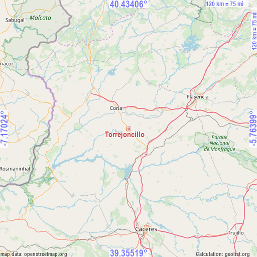
Torrejoncillo GPS coordinates[2]
39° 53' 48.3" North, 6° 28' 1.632" West
| Map corner | latitude | longitude |
|---|---|---|
| Upper-left | 40.43406°, | -7.17024° |
| Center: | 39.89675°, | -6.46712° |
| Lower-right: | 39.35519°, | -5.76399° |
| Map W x H: | 120×120 km | = 74.6×74.6mi |
| max Lat: | 43.74134° ⇑71.7% North |
| Torrejoncillo: | 39.89675° |
| min Lat: | ⇓28.3% South 27.64134° |
| min Long | Torrejoncillo | max Long |
| -18.00367° | -6.46712° | 4.2899° |
| W 9.1%⇐ | ⇒90.9% E |
Elevation
Elevation of Torrejoncillo is 336 m = 1102 ft, and this is 262 m = 860 ft below average elevation for this country.
| Max E: |
1682 m = 5518 ft | 72.8% |
| Avg. | 598 m = 1962 ft | |
| Torrejoncillo | 336 m = 1102 ft | |
Min E: |
0 m = 0 ft | 27.2% |
See also: Spain elevation on elevation.city.
Geographical zone
Torrejoncillo is located in North temperate zone (between Tropic of Cancer and the Arctic Circle). Distance of this Northern Tropic circle is 1830.2 km =1137.2 mi to South.| Distance of | km | miles | from Torrejoncillo |
|---|---|---|---|
| North Pole | 5571 | 3461.7 | to North |
| Arctic Circle | 2965.1 | 1842.4 | to North |
| Tropic Cancer | 1830.2 | 1137.2 | to South |
| Equator | 4436.1 | 2756.5 | to South |


Nearby cities:
15 places around Torrejoncillo: (largest is in red/bold)
• Acehuche
17.7 km =11 mi,  233°
233°
• Cachorrilla
17.4 km =10.8 mi,  276°
276°
• Calzadilla
19 km =11.8 mi,  342°
342°
• Casas de Don Gómez
16.9 km =10.5 mi,  317°
317°
• Casas de Millán
14.7 km =9.1 mi,  126°
126°
• Casillas de Coria
16.4 km =10.2 mi,  297°
297°
• Cañaveral
13.3 km =8.3 mi,  150°
150°
• Coria
11.3 km =7 mi,  328°
328°
• Holguera
10 km =6.2 mi,  88°
88°
• Morcillo
14.8 km =9.2 mi,  23°
23°
• Pedroso de Acim
9.2 km =5.7 mi, 149°
• Pescueza
15.4 km =9.6 mi, 278°
• Portaje
8.4 km =5.2 mi,  285°
285°
• Portezuelo
9.4 km =5.8 mi,  183°
183°
• Ríolobos
14.2 km =8.8 mi,  79°
79°
Sources, notices
• [Note1] Compared only with cities in Spain existing in our database
• [Src1] Map data: © OpenStreetMap contributors (CC-BY-SA)
• [Src2] Other city data from geonames.org with taken over terms of usage.
• [Src3] Geographical zone / Annual Mean Temperature by Robert A. Rohde @ Wikipedia
