Corral de Almaguer geodata
Corral de Almaguer (Castille-La Mancha) is a seat of a third-order administrative division; located in Spain in Europe/Madrid (GMT+2) time zone. With population of 5,743 people, there are 1170 cities with bigger population in this country. Compared to other cities in Spain, 73.4% of cities are located further ↑North; 52% of cities are located further ←West and 54.6% of cities have lower elevation than Corral de Almaguer. Note1
Administrative division(s):
- Level 1: Castille-La Mancha
- Level 2: Province of Toledo
- Level 3: Corral de Almaguer


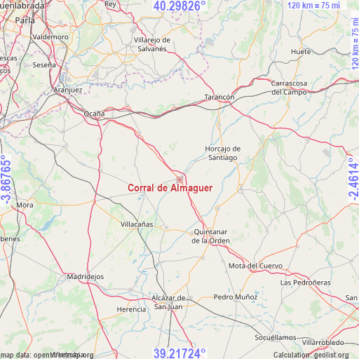
Corral de Almaguer GPS coordinates[2]
39° 45' 35.532" North, 3° 9' 52.272" West
| Map corner | latitude | longitude |
|---|---|---|
| Upper-left | 40.29826°, | -3.86765° |
| Center: | 39.75987°, | -3.16452° |
| Lower-right: | 39.21724°, | -2.4614° |
| Map W x H: | 120.2×120.2 km | = 74.7×74.7mi |
| max Lat: | 43.74134° ⇑73.4% North |
| Corral de Almaguer: | 39.75987° |
| min Lat: | ⇓26.6% South 27.64134° |
| min Long | Corral de Almag | max Long |
| -18.00367° | -3.16452° | 4.2899° |
| W 52%⇐ | ⇒48% E |
Elevation
Elevation of Corral de Almaguer is 706 m = 2316 ft, and this is 108 m = 354 ft above average elevation for this country.
| Max E: |
1682 m = 5518 ft | 45.4% |
| Corral de Almaguer | 706 m 2316 ft | |
| Avg. | 598 m = 1962 ft | |
Min E: |
0 m = 0 ft | 54.6% |
See also: Spain elevation on elevation.city.
Geographical zone
Corral de Almaguer is located in North temperate zone (between Tropic of Cancer and the Arctic Circle). Distance of this Northern Tropic circle is 1815 km =1127.8 mi to South.| Distance of | km | miles | from Corral de Almaguer |
|---|---|---|---|
| North Pole | 5586.2 | 3471.1 | to North |
| Arctic Circle | 2980.3 | 1851.9 | to North |
| Tropic Cancer | 1815 | 1127.8 | to South |
| Equator | 4420.9 | 2747 | to South |


Nearby cities:
15 places around Corral de Almaguer: (largest is in red/bold)
• Cabezamesada
8.2 km =5.1 mi,  40°
40°
• Fuente de Pedro Naharro
22.6 km =14 mi, 35°
• Horcajo de Santiago
17 km =10.6 mi,  57°
57°
• La Puebla de Almoradiel
18.4 km =11.4 mi,  167°
167°
• Lillo
12.8 km =8 mi,  251°
251°
• Pozorrubio
19.4 km =12.1 mi,  71°
71°
• Quintanar de la Orden
21.3 km =13.2 mi,  150°
150°
• Romeral
23.8 km =14.8 mi,  255°
255°
• Santa Cruz de la Zarza
24.7 km =15.3 mi,  355°
355°
• Torrubia del Campo
23.1 km =14.4 mi,  48°
48°
• Villa de Don Fadrique
16.8 km =10.4 mi,  196°
196°
• Villacañas
21.2 km =13.2 mi,  224°
224°
• Villamayor de Santiago
20.9 km =13 mi,  98°
98°
• Villanueva de Alcardete
16 km =9.9 mi,  126°
126°
• Villatobas
20.8 km =12.9 mi,  319°
319°
Sources, notices
• [Note1] Compared only with cities in Spain existing in our database
• [Src1] Map data: © OpenStreetMap contributors (CC-BY-SA)
• [Src2] Other city data from geonames.org with taken over terms of usage.
• [Src3] Geographical zone / Annual Mean Temperature by Robert A. Rohde @ Wikipedia
