Barrax geodata
Barrax (Castille-La Mancha) is a seat of a third-order administrative division; located in Spain in Europe/Madrid (GMT+2) time zone. With population of 1,993 people, there are 2171 cities with bigger population in this country. Compared to other cities in Spain, 80.6% of cities are located further ↑North; 64.7% of cities are located further ←West and 58.7% of cities have lower elevation than Barrax. Note1
Administrative division(s):
- Level 1: Castille-La Mancha
- Level 2: Provincia de Albacete
- Level 3: Barrax


Barrax GPS coordinates[2]
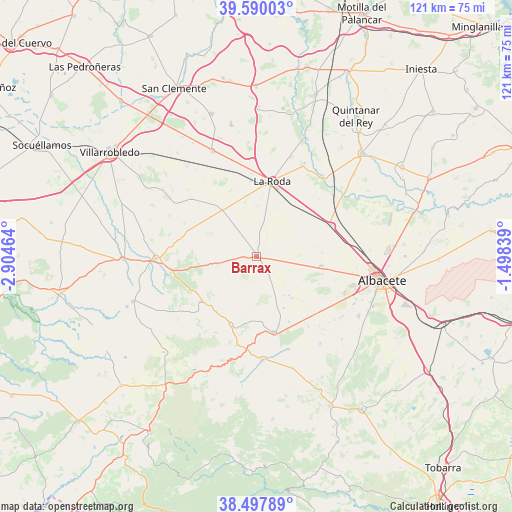
39° 2' 45.852" North, 2° 12' 5.472" West
| Map corner | latitude | longitude |
|---|---|---|
| Upper-left | 39.59003°, | -2.90464° |
| Center: | 39.04607°, | -2.20152° |
| Lower-right: | 38.49789°, | -1.49839° |
| Map W x H: | 121.4×121.4 km | = 75.4×75.4mi |
| max Lat: | 43.74134° ⇑80.6% North |
| Barrax: | 39.04607° |
| min Lat: | ⇓19.4% South 27.64134° |
| min Long | Barrax | max Long |
| -18.00367° | -2.20152° | 4.2899° |
| W 64.7%⇐ | ⇒35.3% E |
Elevation
Elevation of Barrax is 735 m = 2411 ft, and this is 137 m = 449 ft above average elevation for this country.
| Max E: |
1682 m = 5518 ft | 41.3% |
| Barrax | 735 m 2411 ft | |
| Avg. | 598 m = 1962 ft | |
Min E: |
0 m = 0 ft | 58.7% |
See also: Spain elevation on elevation.city.
Geographical zone
Barrax is located in North temperate zone (between Tropic of Cancer and the Arctic Circle). Distance of this Northern Tropic circle is 1735.6 km =1078.5 mi to South.| Distance of | km | miles | from Barrax |
|---|---|---|---|
| North Pole | 5665.5 | 3520.4 | to North |
| Arctic Circle | 3059.7 | 1901.2 | to North |
| Tropic Cancer | 1735.6 | 1078.5 | to South |
| Equator | 4341.5 | 2697.7 | to South |


Nearby cities:
15 places around Barrax: (largest is in red/bold)
• Albacete
30.4 km =18.9 mi,  100°
100°
• Balazote
18.5 km =11.5 mi,  166°
166°
• Casas de Lázaro
30.8 km =19.1 mi,  186°
186°
• El Ballestero
31.6 km =19.6 mi,  224°
224°
• El Bonillo
31.2 km =19.4 mi,  250°
250°
• Fuensanta
23.8 km =14.8 mi,  29°
29°
• La Gineta
19.3 km =12 mi,  66°
66°
• La Roda
18.3 km =11.4 mi,  12°
12°
• Lezuza
17 km =10.6 mi,  230°
230°
• Minaya
27 km =16.8 mi,  337°
337°
• Montalvos
20.8 km =12.9 mi,  49°
49°
• Munera
24.1 km =15 mi,  268°
268°
• Pozuelo
27.7 km =17.2 mi,  161°
161°
• San Pedro
24.6 km =15.3 mi,  176°
176°
• Villagordo del Júcar
30.5 km =19 mi,  22°
22°
Sources, notices
• [Note1] Compared only with cities in Spain existing in our database
• [Src1] Map data: © OpenStreetMap contributors (CC-BY-SA)
• [Src2] Other city data from geonames.org with taken over terms of usage.
• [Src3] Geographical zone / Annual Mean Temperature by Robert A. Rohde @ Wikipedia
