Abarán geodata
Abarán (Murcia) is a populated place; located in Spain in Europe/Madrid (GMT+2) time zone. With population of 12,991 people, there are 705 cities with bigger population in this country. Compared to other cities in Spain, 87.2% of cities are located further ↑North; 73.9% of cities are located further ←West and 81.9% of cities have higher elevation than Abarán. Note1


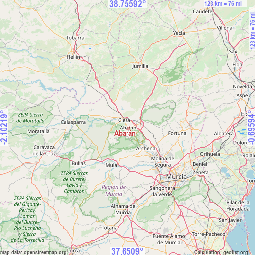
Abarán GPS coordinates[2]
38° 12' 19.836" North, 1° 23' 56.652" West
| Map corner | latitude | longitude |
|---|---|---|
| Upper-left | 38.75592°, | -2.10219° |
| Center: | 38.20551°, | -1.39907° |
| Lower-right: | 37.6509°, | -0.69594° |
| Map W x H: | 122.9×122.9 km | = 76.4×76.4mi |
| max Lat: | 43.74134° ⇑87.2% North |
| Abarán: | 38.20551° |
| min Lat: | ⇓12.8% South 27.64134° |
| min Long | Abarán | max Long |
| -18.00367° | -1.39907° | 4.2899° |
| W 73.9%⇐ | ⇒26.1% E |
Elevation
Elevation of Abarán is 188 m = 617 ft, and this is 410 m = 1345 ft below average elevation for this country.
| Max E: |
1682 m = 5518 ft | 81.9% |
| Avg. | 598 m = 1962 ft | |
| Abarán | 188 m = 617 ft | |
Min E: |
0 m = 0 ft | 18.1% |
See also: Spain elevation on elevation.city.
Geographical zone
Abarán is located in North temperate zone (between Tropic of Cancer and the Arctic Circle). Distance of this Northern Tropic circle is 1642.1 km =1020.4 mi to South.| Distance of | km | miles | from Abarán |
|---|---|---|---|
| North Pole | 5759 | 3578.5 | to North |
| Arctic Circle | 3153.1 | 1959.2 | to North |
| Tropic Cancer | 1642.1 | 1020.4 | to South |
| Equator | 4248.1 | 2639.6 | to South |


Nearby cities:
15 places around Abarán: (largest is in red/bold)
• Albudeite
19.7 km =12.2 mi,  176°
176°
• Alguazas
21.3 km =13.2 mi,  142°
142°
• Archena
13.1 km =8.1 mi, 138°
• Blanca
3.6 km =2.2 mi, 144°
• Campos del Río
18.9 km =11.7 mi,  167°
167°
• Ceuti
17.8 km =11.1 mi, 142°
• Cieza
4.2 km =2.6 mi,  334°
334°
• Fortuna
24 km =14.9 mi,  96°
96°
• Las Torres de Cotillas
24 km =14.9 mi,  145°
145°
• Lorquí
18.8 km =11.7 mi, 136°
• Molina de Segura
23.7 km =14.7 mi, 135°
• Mula
20 km =12.4 mi,  203°
203°
• Ojós
8.2 km =5.1 mi, 142°
• Ricote
6.5 km =4 mi, 153°
• Ulea
9.4 km =5.8 mi, 140°
Sources, notices
• [Note1] Compared only with cities in Spain existing in our database
• [Src1] Map data: © OpenStreetMap contributors (CC-BY-SA)
• [Src2] Other city data from geonames.org with taken over terms of usage.
• [Src3] Geographical zone / Annual Mean Temperature by Robert A. Rohde @ Wikipedia
