Molina de Segura geodata
Molina de Segura (Murcia) is a seat of a third-order administrative division; located in Spain in Europe/Madrid (GMT+2) time zone. With population of 64,065 people, there are 145 cities with bigger population in this country. Compared to other cities in Spain, 88.2% of cities are located further ↑North; 75.6% of cities are located further ←West and 87.2% of cities have higher elevation than Molina de Segura. Note1


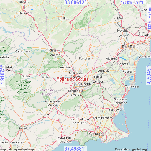
Molina de Segura GPS coordinates[2]
38° 3' 16.416" North, 1° 12' 27.468" West
| Map corner | latitude | longitude |
|---|---|---|
| Upper-left | 38.60612°, | -1.91075° |
| Center: | 38.05456°, | -1.20763° |
| Lower-right: | 37.49881°, | -0.5045° |
| Map W x H: | 123.1×123.1 km | = 76.5×76.5mi |
| max Lat: | 43.74134° ⇑88.2% North |
| Molina de Segura: | 38.05456° |
| min Lat: | ⇓11.8% South 27.64134° |
| min Long | Molina de Segur | max Long |
| -18.00367° | -1.20763° | 4.2899° |
| W 75.6%⇐ | ⇒24.4% E |
Elevation
Elevation of Molina de Segura is 108 m = 354 ft, and this is 490 m = 1608 ft below average elevation for this country.
| Max E: |
1682 m = 5518 ft | 87.2% |
| Avg. | 598 m = 1962 ft | |
| Molina de Segura | 108 m = 354 ft | |
Min E: |
0 m = 0 ft | 12.8% |
See also: Molina de Segura elevation on elevation.city.
Geographical zone
Molina de Segura is located in North temperate zone (between Tropic of Cancer and the Arctic Circle). Distance of this Northern Tropic circle is 1625.4 km =1010 mi to South.| Distance of | km | miles | from Molina de Segura |
|---|---|---|---|
| North Pole | 5775.8 | 3588.9 | to North |
| Arctic Circle | 3169.9 | 1969.7 | to North |
| Tropic Cancer | 1625.4 | 1010 | to South |
| Equator | 4231.3 | 2629.2 | to South |


Nearby cities:
15 places around Molina de Segura: (largest is in red/bold)
• Alcantarilla
9.5 km =5.9 mi,  185°
185°
• Alguazas
3.8 km =2.4 mi,  268°
268°
• Archena
10.6 km =6.6 mi,  310°
310°
• Barrio de San José Obrero
14.2 km =8.8 mi,  101°
101°
• Cabecicos
12 km =7.5 mi,  112°
112°
• Campos del Río
12.8 km =8 mi,  262°
262°
• Ceuti
6.4 km =4 mi,  294°
294°
• Cobatillas
11.5 km =7.1 mi,  89°
89°
• Esparragal
11.1 km =6.9 mi, 102°
• Las Torres de Cotillas
4.2 km =2.6 mi,  225°
225°
• Lorquí
4.9 km =3 mi, 309°
• Murcia
10.1 km =6.3 mi,  137°
137°
• Sangonera la Verde
14 km =8.7 mi,  180°
180°
• Santa Cruz
13.6 km =8.5 mi, 105°
• Santomera
13.9 km =8.6 mi, 86°
Sources, notices
• [Note1] Compared only with cities in Spain existing in our database
• [Src1] Map data: © OpenStreetMap contributors (CC-BY-SA)
• [Src2] Other city data from geonames.org with taken over terms of usage.
• [Src3] Geographical zone / Annual Mean Temperature by Robert A. Rohde @ Wikipedia
