Zarzosa geodata
Zarzosa (La Rioja) is a seat of a third-order administrative division; located in Spain in Europe/Madrid (GMT+2) time zone. With population of 14 people, there are 6750 cities with bigger population in this country. Compared to other cities in Spain, 78.8% of cities are located further ↓South; 62.9% of cities are located further ←West and 86.6% of cities have lower elevation than Zarzosa. Note1


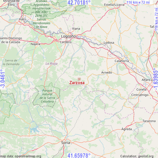
Zarzosa GPS coordinates[2]
42° 10' 58.584" North, 2° 20' 34.692" West
| Map corner | latitude | longitude |
|---|---|---|
| Upper-left | 42.70181°, | -3.0461° |
| Center: | 42.18294°, | -2.34297° |
| Lower-right: | 41.65978°, | -1.63985° |
| Map W x H: | 115.9×115.9 km | = 72×72mi |
| max Lat: | 43.74134° ⇑21.2% North |
| Zarzosa: | 42.18294° |
| min Lat: | ⇓78.8% South 27.64134° |
| min Long | Zarzosa | max Long |
| -18.00367° | -2.34297° | 4.2899° |
| W 62.9%⇐ | ⇒37.1% E |
Elevation
Elevation of Zarzosa is 975 m = 3199 ft, and this is 377 m = 1237 ft above average elevation for this country.
| Max E: |
1682 m = 5518 ft | 13.4% |
| Zarzosa | 975 m 3199 ft | |
| Avg. | 598 m = 1962 ft | |
Min E: |
0 m = 0 ft | 86.6% |
See also: Spain elevation on elevation.city.
Geographical zone
Zarzosa is located in North temperate zone (between Tropic of Cancer and the Arctic Circle). Distance of this Northern Tropic circle is 2084.4 km =1295.2 mi to South.| Distance of | km | miles | from Zarzosa |
|---|---|---|---|
| North Pole | 5316.8 | 3303.7 | to North |
| Arctic Circle | 2710.9 | 1684.5 | to North |
| Tropic Cancer | 2084.4 | 1295.2 | to South |
| Equator | 4690.3 | 2914.4 | to South |


Nearby cities:
15 places around Zarzosa: (largest is in red/bold)
• Ajamil
12 km =7.5 mi,  261°
261°
• Arnedillo
9.4 km =5.8 mi,  69°
69°
• Enciso
7.1 km =4.4 mi,  121°
121°
• Hornillos de Cameros
7 km =4.3 mi,  295°
295°
• Jalón de Cameros
12.7 km =7.9 mi,  287°
287°
• Munilla
4 km =2.5 mi,  80°
80°
• Préjano
13.4 km =8.3 mi,  88°
88°
• Rabanera
11.9 km =7.4 mi,  273°
273°
• Robres del Castillo
11.1 km =6.9 mi,  21°
21°
• San Román de Cameros
12.1 km =7.5 mi, 297°
• Santa Eulalia Bajera
12.8 km =8 mi, 76°
• Soto en Cameros
13.3 km =8.3 mi,  329°
329°
• Terroba
11.8 km =7.3 mi,  315°
315°
• Villar del Río
11.9 km =7.4 mi,  183°
183°
• Yanguas
9 km =5.6 mi, 178°
Sources, notices
• [Note1] Compared only with cities in Spain existing in our database
• [Src1] Map data: © OpenStreetMap contributors (CC-BY-SA)
• [Src2] Other city data from geonames.org with taken over terms of usage.
• [Src3] Geographical zone / Annual Mean Temperature by Robert A. Rohde @ Wikipedia
