Cernadilla geodata
Cernadilla (Castille and León) is a seat of a third-order administrative division; located in Spain in Europe/Madrid (GMT+2) time zone. With population of 173 people, there are 5237 cities with bigger population in this country. Compared to other cities in Spain, 74.2% of cities are located further ↓South; 90.6% of cities are located further →East and 81.1% of cities have lower elevation than Cernadilla. Note1
Administrative division(s):
- Level 1: Castille and León
- Level 2: Provincia de Zamora
- Level 3: Cernadilla


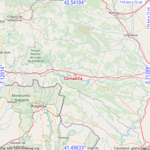
Cernadilla GPS coordinates[2]
42° 1' 14.988" North, 6° 25' 1.236" West
| Map corner | latitude | longitude |
|---|---|---|
| Upper-left | 42.54104°, | -7.12014° |
| Center: | 42.02083°, | -6.41701° |
| Lower-right: | 41.49633°, | -5.71389° |
| Map W x H: | 116.2×116.2 km | = 72.2×72.2mi |
| max Lat: | 43.74134° ⇑25.8% North |
| Cernadilla: | 42.02083° |
| min Lat: | ⇓74.2% South 27.64134° |
| min Long | Cernadilla | max Long |
| -18.00367° | -6.41701° | 4.2899° |
| W 9.4%⇐ | ⇒90.6% E |
Elevation
Elevation of Cernadilla is 907 m = 2976 ft, and this is 309 m = 1014 ft above average elevation for this country.
| Max E: |
1682 m = 5518 ft | 18.9% |
| Cernadilla | 907 m 2976 ft | |
| Avg. | 598 m = 1962 ft | |
Min E: |
0 m = 0 ft | 81.1% |
See also: Spain elevation on elevation.city.
Geographical zone
Cernadilla is located in North temperate zone (between Tropic of Cancer and the Arctic Circle). Distance of this Northern Tropic circle is 2066.4 km =1284 mi to South.| Distance of | km | miles | from Cernadilla |
|---|---|---|---|
| North Pole | 5334.8 | 3314.9 | to North |
| Arctic Circle | 2728.9 | 1695.7 | to North |
| Tropic Cancer | 2066.4 | 1284 | to South |
| Equator | 4672.3 | 2903.2 | to South |


Nearby cities:
15 places around Cernadilla: (largest is in red/bold)
• Asturianos
6.9 km =4.3 mi,  300°
300°
• Espadañedo
10.8 km =6.7 mi,  10°
10°
• Figueruela de Arriba
17.1 km =10.6 mi,  187°
187°
• Justel
17.4 km =10.8 mi,  35°
35°
• Mahide
17.2 km =10.7 mi,  169°
169°
• Manzanal de Arriba
3.7 km =2.3 mi,  210°
210°
• Manzanal de los Infantes
4.7 km =2.9 mi, 37°
• Molezuelas de la Carballeda
20.1 km =12.5 mi,  70°
70°
• Mombuey
7.2 km =4.5 mi,  88°
88°
• Muelas de los Caballeros
13.7 km =8.5 mi,  28°
28°
• Palacios de Sanabria
9.8 km =6.1 mi, 295°
• Peque
13.1 km =8.1 mi,  63°
63°
• Puebla de Sanabria
18.3 km =11.4 mi,  281°
281°
• Robleda-Cervantes
16.2 km =10.1 mi, 295°
• Villardeciervos
13.9 km =8.6 mi,  129°
129°
Sources, notices
• [Note1] Compared only with cities in Spain existing in our database
• [Src1] Map data: © OpenStreetMap contributors (CC-BY-SA)
• [Src2] Other city data from geonames.org with taken over terms of usage.
• [Src3] Geographical zone / Annual Mean Temperature by Robert A. Rohde @ Wikipedia
