Villapedre geodata
Villapedre (Asturias) is a populated locality; located in Spain in Europe/Madrid (GMT+2) time zone. With population of 690 people, there are 3418 cities with bigger population in this country. Compared to other cities in Spain, 99.7% of cities are located further ↓South; 92.4% of cities are located further →East and 89.8% of cities have higher elevation than Villapedre. Note1


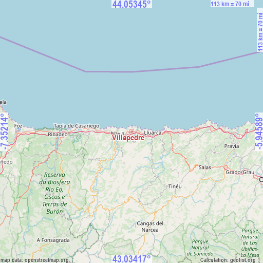
Villapedre GPS coordinates[2]
43° 32' 45.456" North, 6° 38' 56.436" West
| Map corner | latitude | longitude |
|---|---|---|
| Upper-left | 44.05345°, | -7.35214° |
| Center: | 43.54596°, | -6.64901° |
| Lower-right: | 43.03417°, | -5.94589° |
| Map W x H: | 113.3×113.3 km | = 70.4×70.4mi |
| max Lat: | 43.74134° ⇑0.3% North |
| Villapedre: | 43.54596° |
| min Lat: | ⇓99.7% South 27.64134° |
| min Long | Villapedre | max Long |
| -18.00367° | -6.64901° | 4.2899° |
| W 7.6%⇐ | ⇒92.4% E |
Elevation
Elevation of Villapedre is 70 m = 230 ft, and this is 528 m = 1732 ft below average elevation for this country.
| Max E: |
1682 m = 5518 ft | 89.8% |
| Avg. | 598 m = 1962 ft | |
| Villapedre | 70 m = 230 ft | |
Min E: |
0 m = 0 ft | 10.2% |
See also: Spain elevation on elevation.city.
Geographical zone
Villapedre is located in North temperate zone (between Tropic of Cancer and the Arctic Circle). Distance of this Northern Tropic circle is 2235.9 km =1389.3 mi to South.| Distance of | km | miles | from Villapedre |
|---|---|---|---|
| North Pole | 5165.2 | 3209.5 | to North |
| Arctic Circle | 2559.3 | 1590.3 | to North |
| Tropic Cancer | 2235.9 | 1389.3 | to South |
| Equator | 4841.9 | 3008.6 | to South |


Nearby cities:
15 places around Villapedre: (largest is in red/bold)
• Boal
18.4 km =11.4 mi,  226°
226°
• Castropol
30.8 km =19.1 mi,  266°
266°
• Coaña
9.3 km =5.8 mi,  247°
247°
• El Franco
17.5 km =10.9 mi, 273°
• Figueras
30.4 km =18.9 mi, 268°
• Illano
29.4 km =18.3 mi,  216°
216°
• Navia
5.8 km =3.6 mi,  258°
258°
• Pesoz
37.3 km =23.2 mi,  208°
208°
• Pola de Allande
30.4 km =18.9 mi,  175°
175°
• Ribadeo
31.6 km =19.6 mi, 268°
• Salas
34.7 km =21.6 mi,  115°
115°
• Tapia de Casariego
23.9 km =14.9 mi,  276°
276°
• Tineo
29.9 km =18.6 mi,  140°
140°
• Vegadeo
33.8 km =21 mi, 255°
• Vilaión
11.7 km =7.3 mi,  202°
202°
Sources, notices
• [Note1] Compared only with cities in Spain existing in our database
• [Src1] Map data: © OpenStreetMap contributors (CC-BY-SA)
• [Src2] Other city data from geonames.org with taken over terms of usage.
• [Src3] Geographical zone / Annual Mean Temperature by Robert A. Rohde @ Wikipedia
