Vilanova de Arousa geodata
Vilanova de Arousa (Galicia) is a populated place; located in Spain in Europe/Madrid (GMT+2) time zone. With population of 10,719 people, there are 816 cities with bigger population in this country. Compared to other cities in Spain, 88.6% of cities are located further ↓South; 98% of cities are located further →East and 99.5% of cities have higher elevation than Vilanova de Arousa. Note1
Administrative division(s):
- Level 1: Galicia
- Level 2: Provincia de Pontevedra
- Level 3: Vilanova de Arousa


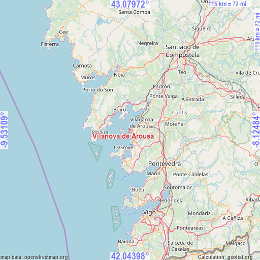
Vilanova de Arousa GPS coordinates[2]
42° 33' 50.4" North, 8° 49' 40.692" West
| Map corner | latitude | longitude |
|---|---|---|
| Upper-left | 43.07972°, | -9.53109° |
| Center: | 42.564°, | -8.82797° |
| Lower-right: | 42.04398°, | -8.12484° |
| Map W x H: | 115.2×115.2 km | = 71.6×71.6mi |
| max Lat: | 43.74134° ⇑11.4% North |
| Vilanova de Arousa: | 42.564° |
| min Lat: | ⇓88.6% South 27.64134° |
| min Long | Vilanova de Aro | max Long |
| -18.00367° | -8.82797° | 4.2899° |
| W 2%⇐ | ⇒98% E |
Elevation
Elevation of Vilanova de Arousa is 6 m = 20 ft, and this is 592 m = 1942 ft below average elevation for this country.
| Max E: |
1682 m = 5518 ft | 99.5% |
| Avg. | 598 m = 1962 ft | |
| Vilanova de Arousa | 6 m = 20 ft | |
Min E: |
0 m = 0 ft | 0.5% |
See also: Spain elevation on elevation.city.
Geographical zone
Vilanova de Arousa is located in North temperate zone (between Tropic of Cancer and the Arctic Circle). Distance of this Northern Tropic circle is 2126.8 km =1321.5 mi to South.| Distance of | km | miles | from Vilanova de Arousa |
|---|---|---|---|
| North Pole | 5274.4 | 3277.4 | to North |
| Arctic Circle | 2668.5 | 1658.1 | to North |
| Tropic Cancer | 2126.8 | 1321.5 | to South |
| Equator | 4732.7 | 2940.8 | to South |


Nearby cities:
15 places around Vilanova de Arousa: (largest is in red/bold)
• A Pobra do Caramiñal
10 km =6.2 mi,  295°
295°
• Boiro
10.4 km =6.5 mi,  333°
333°
• Cambados
5.9 km =3.7 mi,  168°
168°
• Catoira
14.3 km =8.9 mi,  36°
36°
• Illa de Arousa
3.7 km =2.3 mi,  269°
269°
• Meaño
13.6 km =8.5 mi,  163°
163°
• Meis
9.6 km =6 mi,  138°
138°
• O Grove
8.3 km =5.2 mi,  201°
201°
• Palmeira
10.2 km =6.3 mi,  282°
282°
• Rianxo
9.6 km =6 mi,  5°
5°
• Ribadumia
8.3 km =5.2 mi,  129°
129°
• Santa Uxía de Ribeira
13.4 km =8.3 mi, 265°
• Sobradelo
4.2 km =2.6 mi,  59°
59°
• Vilagarcía de Arousa
6.3 km =3.9 mi, 55°
• Vilaxoán
3.6 km =2.2 mi,  52°
52°
Sources, notices
• [Note1] Compared only with cities in Spain existing in our database
• [Src1] Map data: © OpenStreetMap contributors (CC-BY-SA)
• [Src2] Other city data from geonames.org with taken over terms of usage.
• [Src3] Geographical zone / Annual Mean Temperature by Robert A. Rohde @ Wikipedia
