Rianxo geodata
Rianxo (Galicia) is a seat of a third-order administrative division; located in Spain in Europe/Madrid (GMT+2) time zone. With population of 11,769 people, there are 755 cities with bigger population in this country. Compared to other cities in Spain, 90.7% of cities are located further ↓South; 98% of cities are located further →East and 95.4% of cities have higher elevation than Rianxo. Note1


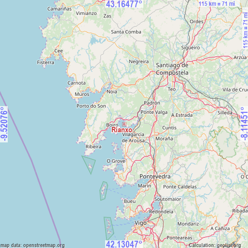
Rianxo GPS coordinates[2]
42° 38' 59.172" North, 8° 49' 3.468" West
| Map corner | latitude | longitude |
|---|---|---|
| Upper-left | 43.16477°, | -9.52076° |
| Center: | 42.64977°, | -8.81763° |
| Lower-right: | 42.13047°, | -8.11451° |
| Map W x H: | 115×115 km | = 71.5×71.5mi |
| max Lat: | 43.74134° ⇑9.3% North |
| Rianxo: | 42.64977° |
| min Lat: | ⇓90.7% South 27.64134° |
| min Long | Rianxo | max Long |
| -18.00367° | -8.81763° | 4.2899° |
| W 2%⇐ | ⇒98% E |
Elevation
Elevation of Rianxo is 23 m = 75 ft, and this is 575 m = 1886 ft below average elevation for this country.
| Max E: |
1682 m = 5518 ft | 95.4% |
| Avg. | 598 m = 1962 ft | |
| Rianxo | 23 m = 75 ft | |
Min E: |
0 m = 0 ft | 4.6% |
See also: Spain elevation on elevation.city.
Geographical zone
Rianxo is located in North temperate zone (between Tropic of Cancer and the Arctic Circle). Distance of this Northern Tropic circle is 2136.3 km =1327.4 mi to South.| Distance of | km | miles | from Rianxo |
|---|---|---|---|
| North Pole | 5264.9 | 3271.5 | to North |
| Arctic Circle | 2659 | 1652.2 | to North |
| Tropic Cancer | 2136.3 | 1327.4 | to South |
| Equator | 4742.2 | 2946.7 | to South |


Nearby cities:
15 places around Rianxo: (largest is in red/bold)
• A Pobra do Caramiñal
11.2 km =7 mi,  242°
242°
• Boiro
5.5 km =3.4 mi,  267°
267°
• Caldas de Reis
15.2 km =9.4 mi,  109°
109°
• Cambados
15.3 km =9.5 mi,  178°
178°
• Catoira
8 km =5 mi,  75°
75°
• Illa de Arousa
10.6 km =6.6 mi,  205°
205°
• Lousame
13 km =8.1 mi,  348°
348°
• Palmeira
13.1 km =8.1 mi, 235°
• Portas
15.1 km =9.4 mi,  118°
118°
• Rois
15.6 km =9.7 mi,  36°
36°
• Sobradelo
7.9 km =4.9 mi,  159°
159°
• Valga
15.5 km =9.6 mi,  69°
69°
• Vilagarcía de Arousa
7.4 km =4.6 mi,  143°
143°
• Vilanova de Arousa
9.6 km =6 mi,  185°
185°
• Vilaxoán
7.6 km =4.7 mi,  165°
165°
Sources, notices
• [Note1] Compared only with cities in Spain existing in our database
• [Src1] Map data: © OpenStreetMap contributors (CC-BY-SA)
• [Src2] Other city data from geonames.org with taken over terms of usage.
• [Src3] Geographical zone / Annual Mean Temperature by Robert A. Rohde @ Wikipedia
