Villalbilla de Burgos geodata
Villalbilla de Burgos (Castille and León) is a seat of a third-order administrative division; located in Spain in Europe/Madrid (GMT+2) time zone. With population of 866 people, there are 3112 cities with bigger population in this country. Compared to other cities in Spain, 83.3% of cities are located further ↓South; 56.5% of cities are located further →East and 72.9% of cities have lower elevation than Villalbilla de Burgos. Note1
Administrative division(s):
- Level 1: Castille and León
- Level 2: Provincia de Burgos
- Level 3: Villalbilla de Burgos
Current local time in Villalbilla de Burgos:
11:08 PM, ThursdayDifference from your time zone: hours


Villalbilla de Burgos GPS coordinates[2]
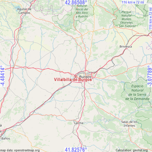
42° 20' 51.252" North, 3° 46' 51.636" West
| Map corner | latitude | longitude |
|---|---|---|
| Upper-left | 42.86508°, | -4.48414° |
| Center: | 42.34757°, | -3.78101° |
| Lower-right: | 41.82576°, | -3.07789° |
| Map W x H: | 115.6×115.6 km | = 71.8×71.8mi |
| max Lat: | 43.74134° ⇑16.7% North |
| Villalbilla de Burgos: | 42.34757° |
| min Lat: | ⇓83.3% South 27.64134° |
| min Long | Villalbilla de | max Long |
| -18.00367° | -3.78101° | 4.2899° |
| W 43.5%⇐ | ⇒56.5% E |
Elevation
Elevation of Villalbilla de Burgos is 834 m = 2736 ft, and this is 236 m = 774 ft above average elevation for this country.
| Max E: |
1682 m = 5518 ft | 27.1% |
| Villalbilla de Burgos | 834 m 2736 ft | |
| Avg. | 598 m = 1962 ft | |
Min E: |
0 m = 0 ft | 72.9% |
See also: Spain elevation on elevation.city.
Geographical zone
Villalbilla de Burgos is located in North temperate zone (between Tropic of Cancer and the Arctic Circle). Distance of this Northern Tropic circle is 2102.7 km =1306.6 mi to South.| Distance of | km | miles | from Villalbilla de Burgos |
|---|---|---|---|
| North Pole | 5298.5 | 3292.3 | to North |
| Arctic Circle | 2692.6 | 1673.1 | to North |
| Tropic Cancer | 2102.7 | 1306.6 | to South |
| Equator | 4708.6 | 2925.8 | to South |


Nearby cities:
15 places around Villalbilla de Burgos: (largest is in red/bold)
• Albillos
7.9 km =4.9 mi,  184°
184°
• Arcos
9.3 km =5.8 mi,  166°
166°
• Buniel
5.2 km =3.2 mi,  220°
220°
• Burgos
6.5 km =4 mi,  96°
96°
• Cardeñadijo
10.6 km =6.6 mi,  118°
118°
• Cayuela
8.9 km =5.5 mi,  200°
200°
• Frandovínez
6.2 km =3.9 mi,  228°
228°
• Gamonal
8.9 km =5.5 mi,  83°
83°
• Quintanilla-Vivar
10.7 km =6.6 mi,  45°
45°
• Rabé de las Calzadas
4.4 km =2.7 mi,  260°
260°
• San Mamés de Burgos
1.6 km =1 mi, 221°
• Sotragero
8.9 km =5.5 mi,  38°
38°
• Tardajos
3 km =1.9 mi,  273°
273°
• Villagonzalo-Pedernales
6.4 km =4 mi,  143°
143°
• Villariezo
9.5 km =5.9 mi,  155°
155°
Sources, notices
• [Note1] Compared only with cities in Spain existing in our database
• [Src1] Map data: © OpenStreetMap contributors (CC-BY-SA)
• [Src2] Other city data from geonames.org with taken over terms of usage.
• [Src3] Geographical zone / Annual Mean Temperature by Robert A. Rohde @ Wikipedia
