San Mamés de Burgos geodata
San Mamés de Burgos (Castille and León) is a seat of a third-order administrative division; located in Spain in Europe/Madrid (GMT+2) time zone. With population of 285 people, there are 4564 cities with bigger population in this country. Compared to other cities in Spain, 82.9% of cities are located further ↓South; 56.7% of cities are located further →East and 74% of cities have lower elevation than San Mamés de Burgos. Note1
Administrative division(s):
- Level 1: Castille and León
- Level 2: Provincia de Burgos
- Level 3: San Mamés de Burgos


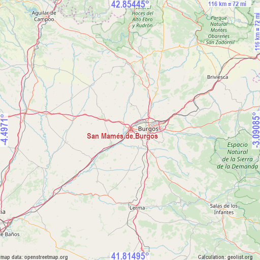
San Mamés de Burgos GPS coordinates[2]
42° 20' 12.66" North, 3° 47' 38.292" West
| Map corner | latitude | longitude |
|---|---|---|
| Upper-left | 42.85445°, | -4.4971° |
| Center: | 42.33685°, | -3.79397° |
| Lower-right: | 41.81495°, | -3.09085° |
| Map W x H: | 115.6×115.6 km | = 71.8×71.8mi |
| max Lat: | 43.74134° ⇑17.1% North |
| San Mamés de Burgos: | 42.33685° |
| min Lat: | ⇓82.9% South 27.64134° |
| min Long | San Mamés de B | max Long |
| -18.00367° | -3.79397° | 4.2899° |
| W 43.3%⇐ | ⇒56.7% E |
Elevation
Elevation of San Mamés de Burgos is 843 m = 2766 ft, and this is 245 m = 804 ft above average elevation for this country.
| Max E: |
1682 m = 5518 ft | 26% |
| San Mamés de Burgos | 843 m 2766 ft | |
| Avg. | 598 m = 1962 ft | |
Min E: |
0 m = 0 ft | 74% |
See also: Spain elevation on elevation.city.
Geographical zone
San Mamés de Burgos is located in North temperate zone (between Tropic of Cancer and the Arctic Circle). Distance of this Northern Tropic circle is 2101.5 km =1305.8 mi to South.| Distance of | km | miles | from San Mamés de Burgos |
|---|---|---|---|
| North Pole | 5299.6 | 3293 | to North |
| Arctic Circle | 2693.8 | 1673.8 | to North |
| Tropic Cancer | 2101.5 | 1305.8 | to South |
| Equator | 4707.4 | 2925 | to South |


Nearby cities:
15 places around San Mamés de Burgos: (largest is in red/bold)
• Albillos
6.7 km =4.2 mi,  176°
176°
• Arcos
8.5 km =5.3 mi,  157°
157°
• Buniel
3.6 km =2.2 mi,  220°
220°
• Burgos
7.6 km =4.7 mi,  86°
86°
• Cayuela
7.5 km =4.7 mi,  195°
195°
• Estépar
10.9 km =6.8 mi,  232°
232°
• Frandovínez
4.7 km =2.9 mi, 230°
• Gamonal
10.2 km =6.3 mi,  77°
77°
• Hornillos del Camino
10.8 km =6.7 mi,  271°
271°
• Rabé de las Calzadas
3.3 km =2.1 mi,  277°
277°
• Sotragero
10.5 km =6.5 mi,  39°
39°
• Tardajos
2.3 km =1.4 mi,  305°
305°
• Villagonzalo-Pedernales
6.2 km =3.9 mi,  129°
129°
• Villalbilla de Burgos
1.6 km =1 mi, 41°
• Villariezo
9 km =5.6 mi,  146°
146°
Sources, notices
• [Note1] Compared only with cities in Spain existing in our database
• [Src1] Map data: © OpenStreetMap contributors (CC-BY-SA)
• [Src2] Other city data from geonames.org with taken over terms of usage.
• [Src3] Geographical zone / Annual Mean Temperature by Robert A. Rohde @ Wikipedia
