Sotragero geodata
Sotragero (Castille and León) is a seat of a third-order administrative division; located in Spain in Europe/Madrid (GMT+2) time zone. With population of 199 people, there are 5042 cities with bigger population in this country. Compared to other cities in Spain, 85.1% of cities are located further ↓South; 55.6% of cities are located further →East and 74.7% of cities have lower elevation than Sotragero. Note1
Administrative division(s):
- Level 1: Castille and León
- Level 2: Provincia de Burgos
- Level 3: Sotragero


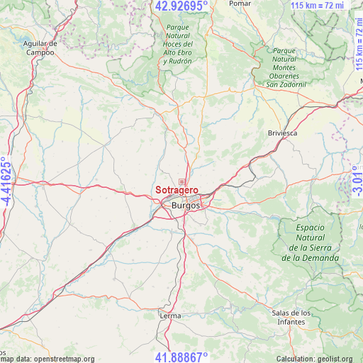
Sotragero GPS coordinates[2]
42° 24' 35.856" North, 3° 42' 47.232" West
| Map corner | latitude | longitude |
|---|---|---|
| Upper-left | 42.92695°, | -4.41625° |
| Center: | 42.40996°, | -3.71312° |
| Lower-right: | 41.88867°, | -3.01° |
| Map W x H: | 115.4×115.4 km | = 71.7×71.7mi |
| max Lat: | 43.74134° ⇑14.9% North |
| Sotragero: | 42.40996° |
| min Lat: | ⇓85.1% South 27.64134° |
| min Long | Sotragero | max Long |
| -18.00367° | -3.71312° | 4.2899° |
| W 44.4%⇐ | ⇒55.6% E |
Elevation
Elevation of Sotragero is 849 m = 2785 ft, and this is 251 m = 823 ft above average elevation for this country.
| Max E: |
1682 m = 5518 ft | 25.3% |
| Sotragero | 849 m 2785 ft | |
| Avg. | 598 m = 1962 ft | |
Min E: |
0 m = 0 ft | 74.7% |
See also: Spain elevation on elevation.city.
Geographical zone
Sotragero is located in North temperate zone (between Tropic of Cancer and the Arctic Circle). Distance of this Northern Tropic circle is 2109.6 km =1310.8 mi to South.| Distance of | km | miles | from Sotragero |
|---|---|---|---|
| North Pole | 5291.5 | 3288 | to North |
| Arctic Circle | 2685.6 | 1668.8 | to North |
| Tropic Cancer | 2109.6 | 1310.8 | to South |
| Equator | 4715.5 | 2930.1 | to South |


Nearby cities:
15 places around Sotragero: (largest is in red/bold)
• Burgos
7.7 km =4.8 mi,  173°
173°
• Cardeñadijo
12.6 km =7.8 mi,  162°
162°
• Cardeñajimeno
11.6 km =7.2 mi,  139°
139°
• Gamonal
6.8 km =4.2 mi,  151°
151°
• Hurones
8 km =5 mi,  93°
93°
• Huérmeces
13.4 km =8.3 mi,  339°
339°
• Quintanaortuño
5.1 km =3.2 mi,  28°
28°
• Quintanilla-Vivar
2.1 km =1.3 mi,  72°
72°
• Rabé de las Calzadas
12.6 km =7.8 mi,  232°
232°
• Rubena
11.6 km =7.2 mi,  102°
102°
• San Mamés de Burgos
10.5 km =6.5 mi,  219°
219°
• Santibáñez-Zarzaguda
9.7 km =6 mi,  323°
323°
• Tardajos
10.9 km =6.8 mi, 231°
• Villagonzalo-Pedernales
12.2 km =7.6 mi,  188°
188°
• Villalbilla de Burgos
8.9 km =5.5 mi, 218°
Sources, notices
• [Note1] Compared only with cities in Spain existing in our database
• [Src1] Map data: © OpenStreetMap contributors (CC-BY-SA)
• [Src2] Other city data from geonames.org with taken over terms of usage.
• [Src3] Geographical zone / Annual Mean Temperature by Robert A. Rohde @ Wikipedia
