Villablino geodata
Villablino (Castille and León) is a populated place; located in Spain in Europe/Madrid (GMT+2) time zone. With population of 10,660 people, there are 819 cities with bigger population in this country. Compared to other cities in Spain, 93.9% of cities are located further ↓South; 89.6% of cities are located further →East and 88.3% of cities have lower elevation than Villablino. Note1
Administrative division(s):
- Level 1: Castille and León
- Level 2: Provincia de León
- Level 3: Palacios del Sil


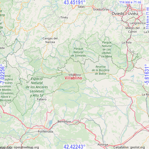
Villablino GPS coordinates[2]
42° 56' 21.552" North, 6° 19' 9.948" West
| Map corner | latitude | longitude |
|---|---|---|
| Upper-left | 43.45191°, | -7.02256° |
| Center: | 42.93932°, | -6.31943° |
| Lower-right: | 42.42243°, | -5.61631° |
| Map W x H: | 114.5×114.5 km | = 71.1×71.1mi |
| max Lat: | 43.74134° ⇑6.1% North |
| Villablino: | 42.93932° |
| min Lat: | ⇓93.9% South 27.64134° |
| min Long | Villablino | max Long |
| -18.00367° | -6.31943° | 4.2899° |
| W 10.4%⇐ | ⇒89.6% E |
Elevation
Elevation of Villablino is 1002 m = 3287 ft, and this is 404 m = 1325 ft above average elevation for this country.
| Max E: |
1682 m = 5518 ft | 11.7% |
| Villablino | 1002 m 3287 ft | |
| Avg. | 598 m = 1962 ft | |
Min E: |
0 m = 0 ft | 88.3% |
See also: Spain elevation on elevation.city.
Geographical zone
Villablino is located in North temperate zone (between Tropic of Cancer and the Arctic Circle). Distance of this Northern Tropic circle is 2168.5 km =1347.4 mi to South.| Distance of | km | miles | from Villablino |
|---|---|---|---|
| North Pole | 5232.7 | 3251.4 | to North |
| Arctic Circle | 2626.8 | 1632.2 | to North |
| Tropic Cancer | 2168.5 | 1347.4 | to South |
| Equator | 4774.4 | 2966.7 | to South |


Nearby cities:
15 places around Villablino: (largest is in red/bold)
• Cabrillanes
14 km =8.7 mi,  83°
83°
• Cerredo
13.9 km =8.6 mi,  273°
273°
• Degaña
20.3 km =12.6 mi, 270°
• Fabero
31.5 km =19.6 mi,  232°
232°
• Folgoso de la Ribera
32.5 km =20.2 mi,  180°
180°
• Igüeña
23.7 km =14.7 mi,  171°
171°
• La Plaza
30.7 km =19.1 mi,  35°
35°
• Murias de Paredes
14.4 km =8.9 mi,  133°
133°
• Palacios del Sil
11.5 km =7.1 mi, 232°
• Peranzanes
26.5 km =16.5 mi,  254°
254°
• Pola de Somiedo
17.8 km =11.1 mi,  16°
16°
• Páramo del Sil
19 km =11.8 mi, 226°
• San Emiliano
26.2 km =16.3 mi, 82°
• Sena de Luna
29.9 km =18.6 mi,  92°
92°
• Toreno
31 km =19.3 mi,  210°
210°
Sources, notices
• [Note1] Compared only with cities in Spain existing in our database
• [Src1] Map data: © OpenStreetMap contributors (CC-BY-SA)
• [Src2] Other city data from geonames.org with taken over terms of usage.
• [Src3] Geographical zone / Annual Mean Temperature by Robert A. Rohde @ Wikipedia
