Peranzanes geodata
Peranzanes (Castille and León) is a seat of a third-order administrative division; located in Spain in Europe/Madrid (GMT+2) time zone. With population of 331 people, there are 4386 cities with bigger population in this country. Compared to other cities in Spain, 93.5% of cities are located further ↓South; 92.2% of cities are located further →East and 85.5% of cities have lower elevation than Peranzanes. Note1
Administrative division(s):
- Level 1: Castille and León
- Level 2: Provincia de León
- Level 3: Peranzanes


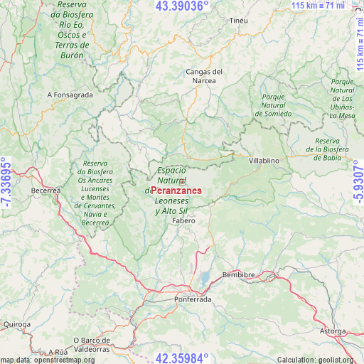
Peranzanes GPS coordinates[2]
42° 52' 38.1" North, 6° 38' 1.788" West
| Map corner | latitude | longitude |
|---|---|---|
| Upper-left | 43.39036°, | -7.33695° |
| Center: | 42.87725°, | -6.63383° |
| Lower-right: | 42.35984°, | -5.9307° |
| Map W x H: | 114.6×114.6 km | = 71.2×71.2mi |
| max Lat: | 43.74134° ⇑6.5% North |
| Peranzanes: | 42.87725° |
| min Lat: | ⇓93.5% South 27.64134° |
| min Long | Peranzanes | max Long |
| -18.00367° | -6.63383° | 4.2899° |
| W 7.8%⇐ | ⇒92.2% E |
Elevation
Elevation of Peranzanes is 958 m = 3143 ft, and this is 360 m = 1181 ft above average elevation for this country.
| Max E: |
1682 m = 5518 ft | 14.5% |
| Peranzanes | 958 m 3143 ft | |
| Avg. | 598 m = 1962 ft | |
Min E: |
0 m = 0 ft | 85.5% |
See also: Spain elevation on elevation.city.
Geographical zone
Peranzanes is located in North temperate zone (between Tropic of Cancer and the Arctic Circle). Distance of this Northern Tropic circle is 2161.6 km =1343.2 mi to South.| Distance of | km | miles | from Peranzanes |
|---|---|---|---|
| North Pole | 5239.6 | 3255.7 | to North |
| Arctic Circle | 2633.7 | 1636.5 | to North |
| Tropic Cancer | 2161.6 | 1343.2 | to South |
| Equator | 4767.5 | 2962.4 | to South |


Nearby cities:
15 places around Peranzanes: (largest is in red/bold)
• Arganza
26.6 km =16.5 mi,  189°
189°
• Berlanga del Bierzo
16.4 km =10.2 mi,  171°
171°
• Candín
10.2 km =6.3 mi,  229°
229°
• Cerredo
14.1 km =8.8 mi,  56°
56°
• Congosto
30.3 km =18.8 mi,  162°
162°
• Cubillos del Sil
28.6 km =17.8 mi, 168°
• Degaña
8.7 km =5.4 mi,  37°
37°
• Fabero
12.2 km =7.6 mi,  177°
177°
• Palacios del Sil
16.5 km =10.3 mi,  90°
90°
• Páramo del Sil
13.5 km =8.4 mi,  117°
117°
• San Antolín
26.5 km =16.5 mi,  312°
312°
• Sancedo
23.4 km =14.5 mi, 180°
• Toreno
22.1 km =13.7 mi,  153°
153°
• Vega de Espinareda
17 km =10.6 mi, 185°
• Villablino
26.5 km =16.5 mi,  74°
74°
Sources, notices
• [Note1] Compared only with cities in Spain existing in our database
• [Src1] Map data: © OpenStreetMap contributors (CC-BY-SA)
• [Src2] Other city data from geonames.org with taken over terms of usage.
• [Src3] Geographical zone / Annual Mean Temperature by Robert A. Rohde @ Wikipedia
